Small windows in between onshore winds
Monday, 1 January 2024
Small windows in between onshore winds
Monday, 1 January 2024
There's plenty of swell this period though with tricky winds and limited windows of clean conditions.
There's plenty of swell this period though with tricky winds and limited windows of clean conditions.
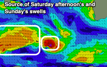
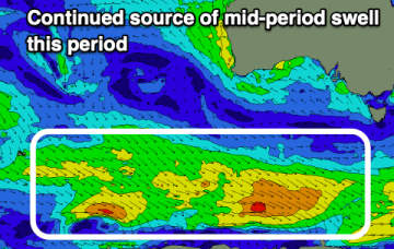
This NE windswell should perk up a notch into Wed as a fetch off the NSW South Coast increases in strength and extends into Eastern Bass Strait.
Varying swell pulses with favourable winds from Thursday through the weekend.
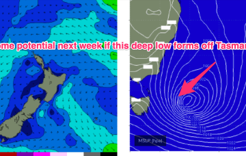
We’ve got a moderate strength high pressure cell (1025hPa) in the Tasman, connected to a high pressure belt under the continent, directing NE winds in Central/Southern NSW, more E-SE in the sub-tropics where a broad troughy area is directing a stronger onshore flow and whipping up local swells from that direction.
Conditions will be generally average this week with cleaner conditions due on the weekend but with small, weak surf.
Not much action ahead for the short run in the f/cast region. Mod/fresh NE winds through Tues and Wed across temperate NSW with lighter N-NW winds inshore early. Local NE winds proximate to the coast and E’ly winds in the Northern Tasman will supply a typical Summer mix of NE and E/NE short period swells.
Lighter winds each morning should provide workable options mostly to the east this period.
No change to the outlook with a lifeless Coral Sea and very weak pressure gradients leading to very light winds in the CQ swell window and more tiny/flat surf over the weekend.
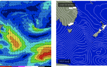
No great change to the weekend f/cast with a weak front having passed the state and a stronger front about to sweep past the Island, bringing new S swell and W, tending SW winds through Sat
There's a ton of swell due this period but windows of clean conditions will be a bit more limited.