Strong swell to end the week
Wednesday, 21 May 2025
Strong swell to end the week
Wednesday, 21 May 2025
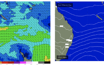
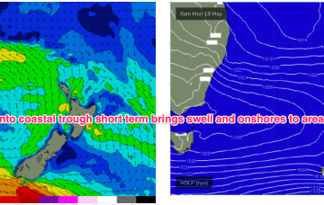
Our strong W/SW groundswell is on track with N-NE winds favouring some spots over others.
Our strong W/SW groundswell is on track with N-NE winds favouring some spots over others.
Make the most of today (South West) ahead of the next round of strong swell early next week with offshore winds.
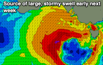
The surf will be best over the coming days ahead of a large, stormy cold outbreak early next week (and much needed soaking).
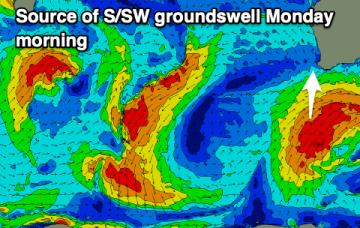
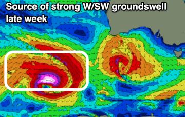
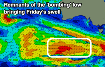
Following a large, strong SW groundswell Friday, early next week looks very dynamic but mostly poor besides Monday afternoon.
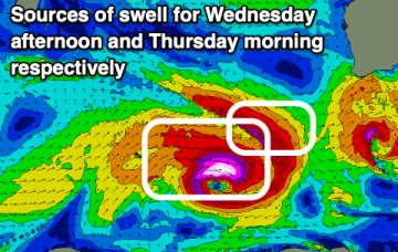
Increasing size and activity from Thursday.
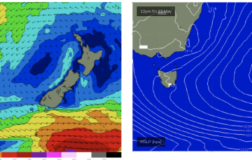
We should see some tiny, possibly just rideable surf from the system through the week, more likely after Wed as the fetch draws out into the Northern Tasman.
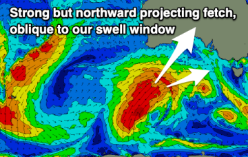
These small lows may move north, then east and finally south or may coalesce in a more classic Tasman Low or ECL variant. Either way we should see some quality E/NE swell for Tas as the fetch draws out through the Tasman.
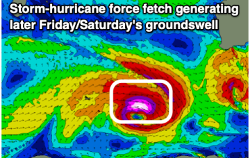
The end of the week looks solid and clean with a strong W/SW groundswell expected.
The surf will be best tomorrow and Wednesday as NW winds spoil an oversized SW groundswell.
These small lows may move north, then east and finally south or may coalesce in a more classic Tasman Low or ECL variant. With so much uncertainty still around be prepared for major revisions as we move through the week. This is a nightmare to forecast!