Strong swell late week

Southern Tasmanian Forecast by Craig Brokensha (issued Monday May 19th)
Best Days: This evening, tomorrow, Wednesday afternoon and Thursday for small waves, Friday, Saturday
Features of the Forecast (tl;dr)
- Easing S/SW swell tomorrow with N/NW tending variable winds
- Small Wed AM, with a slight lift in W/SW swell into the PM, easing Thu
- N/NW tending variable winds Wed/Thu
- Large W/SW groundswell Fri with N/NW tending N/NE winds
- Easing swell Sat with N/NW winds
Recap
The surf was lumpy though with a bit of size Saturday, cleaner yesterday and still a chunky 3ft on the sets.
This morning was back to the 2ft range but we’ve seen a little kick this afternoon back to 2-3ft with offshore winds.
This week and weekend (May 20 - 25)
This afternoon’s reinforcing pulse of S/SW swell is due to back off from tomorrow, still a fun 2ft with offshore N/NW tending variable winds.
A low point in size is due on Wednesday morning, with a small lift in W/SW swell likely into the afternoon, generated by a fast, south-east tracking low from the Bight. A burst of strong to gale-force W/SW winds should kick up 1-2ft waves through the afternoon, easing Thursday from a similar size.
Now, into Friday we’re expected to see a large W/SW groundswell impacting the state, generated by a ‘bombing’ low currently deepening to the east of the Heard Island region.
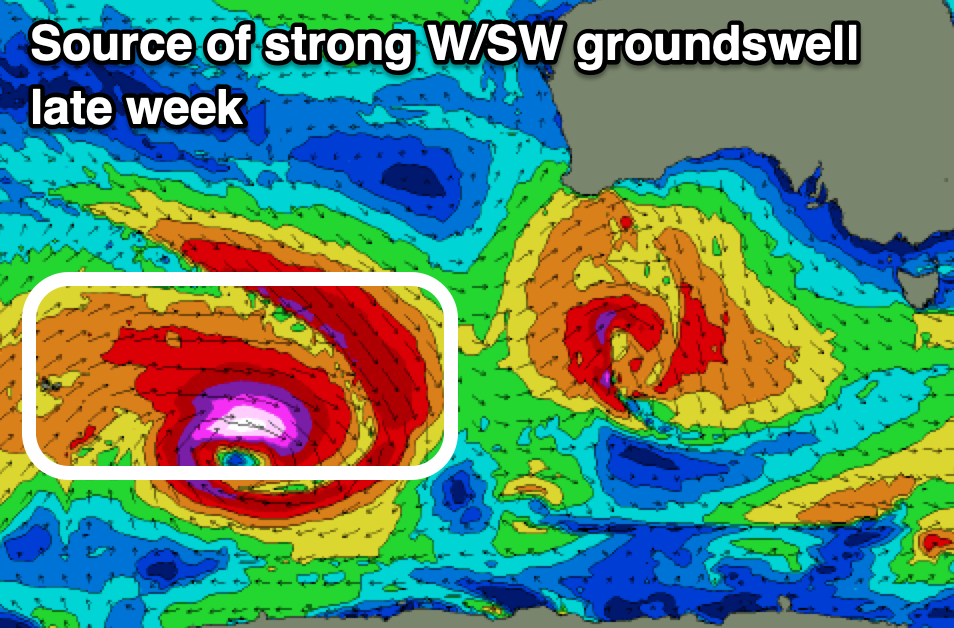
As this low bombs and reaches an incredibly low central pressure of 926hPa, we’ll see a great but tight fetch of storm to hurricane-force W’ly winds generated in our far swell window, expanding while slowly weakening and moving east through this evening and tomorrow.
With the low maintaining severe-gale W’ly winds while moving into our south-western swell window through tomorrow, only breaking down into the evening, we can expect a large sized, long-period W/SW groundswell from this source Friday, peaking to 3-5ft across Clifton (3-4ft mostly) under N/NW tending variable N/NE winds.
The swell will ease steadily through Saturday but still likely be 2-3ft in the morning under offshore winds again.
Sunday/Monday look small to tiny, with a strong Southern Ocean frontal progression set to bring some large windy swell into the early-middle of next week. More on this Wednesday.