Fun waves and dynamic synoptics abound
Friday, 9 May 2025
Fun waves and dynamic synoptics abound
Friday, 9 May 2025
There’s actually a couple of E/NE swell sources for early next week. And a S'ly swell too!
There’s actually a couple of E/NE swell sources for early next week. And a S'ly swell too!
No major changes to the weekend forecast, with a reinforcing W/SW swell expected to push through overnight tonight.
A strong succession of fronts and lows will march from Madagascar through to WA longitudes, each working on the pre-existing active sea state from the last system, generating successively bigger swells for the region.
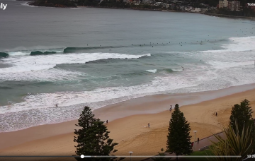
Either way the weekend’s looking fun both days but Sunday is my pick overall.
Fortunately, high pressure will move in and rapidly ease local winds, so apart from some lingering lumpiness, we should see rapidly improving conditions across all coasts (more quickly on the Mid than down south, mind).
Today’s strong groundswell is expected to peak overnight or early Thursday morning before easing slowly through Thursday.
Big, slow moving high in the Tasman next week will slowly migrate towards New Zealand, holding a broad fetch of E’ly winds across the Coral Sea, South Pacific slot and into the Northern Tasman.
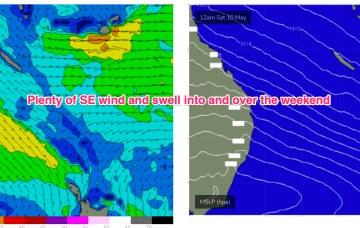
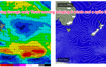
In between, a trough and cold front are currently approaching Tasmania, expected to bring a vigorous W/SW-SW flow o/night into tomorrow, bringing a spike in short range S swell short term.
The Eastern seaboard is in between two large highs at the moment with a system near New Zealand still generating surf via a tradewind fetch and a new system moving through the Bight about to replicate it.
In between, a trough and cold front are currently approaching Tasmania, expected to bring a vigorous S’ly change o/night, bringing a spike in short range S swell short term.