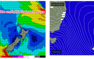
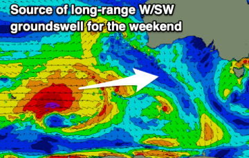
NE windswell followed by S swells next week
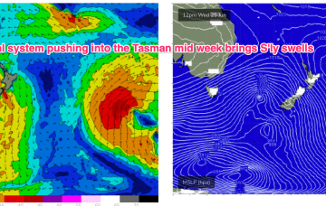
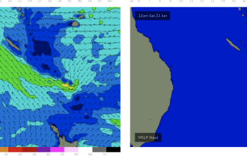
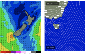
N’lies freshen Tues as the large low/front approaches, tending NW through the a’noon, even W/NW by close of play.
High pressure across the interior of NSW will be moving across Southern NSW into the Tasman, with a trade fetch currently anchored by a small low sliding off to the SE over the weekend.
A trade fetch with a small low at the SE edge of the fetch is supplying small surf to the sub-tropics, with a minor amount expected to slowly filter down into more temperate regions.
The weekend looks fun with north winds and a good W/SW-SW groundswell, large, stormy and windy early-mid next week.
Northerly winds and a good, new swell are due on the weekend. Mid-next week looks to become large and windy with snow in the alpine regions.
Metro regions have a few fun days ahead while Margs will see a couple of windows over the next 7 days
We’ll see rideable surf develop through tomorrow and extend into the weekend under SE winds. Rideable,fun surf should persist into early next week before easing.
The broad SE’ly pattern which sets up in the Coral Sea gets disrupted next week by cold fronts whihc generate surf for NETas but longer term looks to set up again as we move to the end of the month.
The coming days will remain small to tiny ahead of increasing frontal activity and surf mid-next week.