Analysing autumn 2021

Craig takes his seasonal review of the weather patterns during the previous three months.
And just like that, we find ourselves at the start of June, wondering where the last five months have gone.
A La Niña summer brought wetter, cooler, wetter across most of the country, and consistent surf for the East Coast, though less so the southern states. This was followed by an autumn which turned on across all parts of the country at alternating stages, though the contrast between months was stark as you'll see below.
The influence of the summer La Niña lingered across most surfable coasts into March with the southern states failing to see any major Southern Ocean frontal activity. Winds started to improve mid-March providing better options across exposed breaks in Victoria and South Australia, and with the subdued swell activity this was welcomed.
The East Coast saw a deluge of rain into the second half of March as troughy weather sat along the Dividing Range, drawing in moisture form the western Pacific Ocean and Coral Sea. The stationary nature of the pattern brought record rainfall to some regions, which, hitting an already saturated ground, resulted in widespread flooding and communities getting cut off.
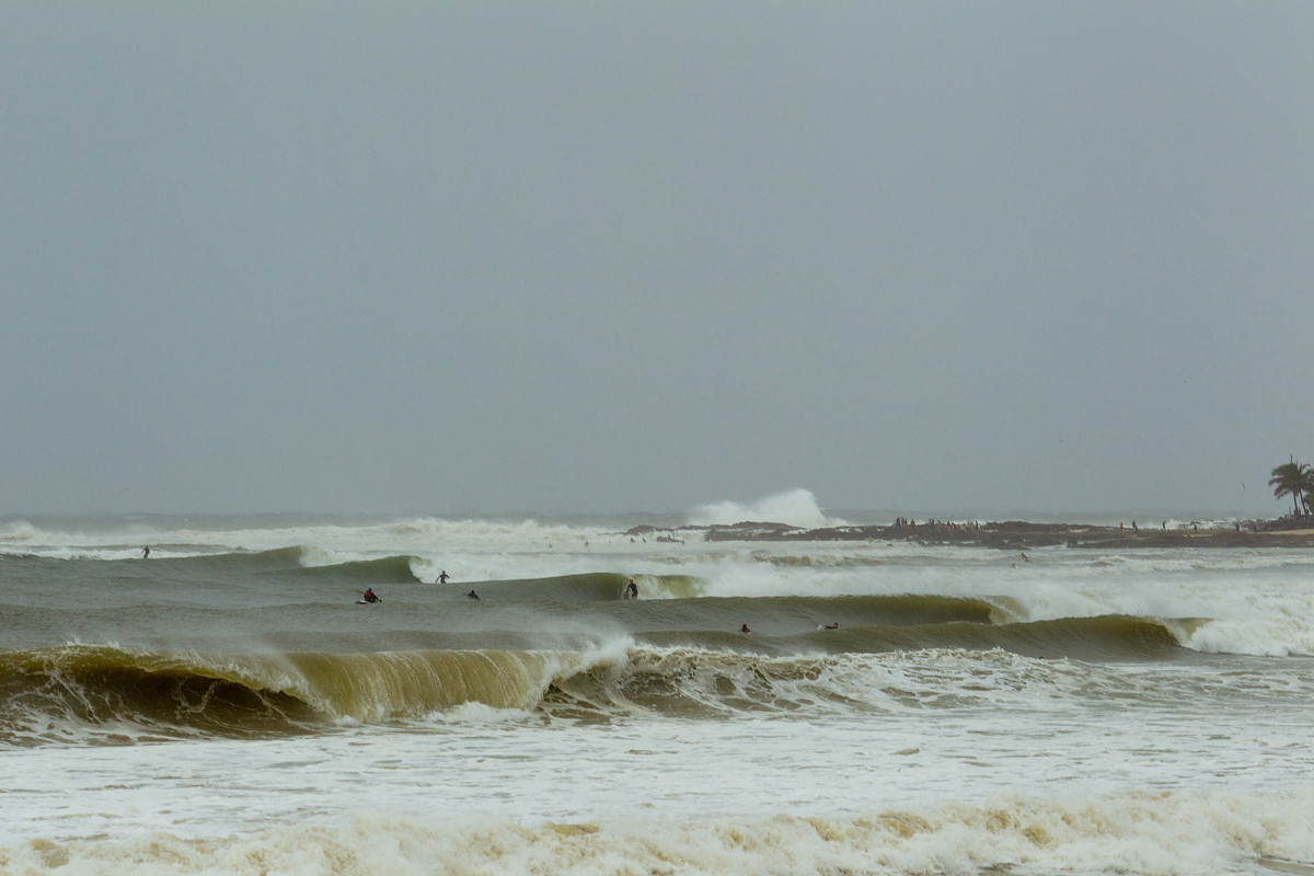
River runoff turns Greenmount brown. Shot by Andrew Shield
There was plenty of surf out of the east, but surfing close to any river outlet was a risk with the large outflows, containing debris and pollution. North-east Tasmania saw pulses of S'ly swell through the first half of the month ahead of a great E/NE groundswell late month as a deep Tasman Low drifted slowly south-east through their swell window.
The chart below shows the Mean Sea Level Pressure anomaly for the month of March. The anomaly is the difference in pressure between the long-term climate average, with the blue and purple colours indicating that it was lower than the long-term average, while the yellow to red indicate it was higher. Keeping in mind that winds move clockwise around lows and anti-clockwise around highs you get a general idea of the setup through March.

March Mean Sea Level Pressure anomaly
What stands out is the low pressure anomaly siting across the eastern states and throughout the Tasman Sea, the vertically aligned low pressure anomaly spreading from the Indian Ocean south and the high pressure anomaly south-west of Tasmania, extending under the Tasman Sea and east of New Zealand.
The depression across the eastern states produced the aforementioned wet weather, while the high below Tasmania put a block across Victoria's south and south-western swell windows. That vertical depression west of Western Australia was a result of Southern Ocean storms projecting up into the mid-latitude's but then deflecting to the south-east on approach to the mainland, while tropical cyclones developed further north, closer to Indonesia and off the north-west of the country.
With the storms remaining at arm's length to Western Australia there were lots of clean, fun days of surf during March. April, however, hit the brakes, but more on this below.

North Steyne goodness, late March. Captured by Craig Brokensha
Below is the Mean Sea Level Pressure anomaly chart for April, and what a contrast it is compared to March, especially for the southern states.

April Mean Sea Level Pressure anomaly
What's immediately obvious in April is the large, low pressure anomaly smack bang in South Australia's and Victoria's swell windows, and the blocking high south-west of Western Australia.
This is when the switch flicked for the Surf Coast, with an initial bombing low firing up through the early stages of the month, bringing very large surf to the reefs. Follow up mid-latitude and Southern Ocean frontal activity along with another bombing low provided endless days of pumping surf for the wave-starved state, though tapering into May.
South Australia also faired will with clean conditions and plenty of days at the deepwater reefs around Victor Harbor.
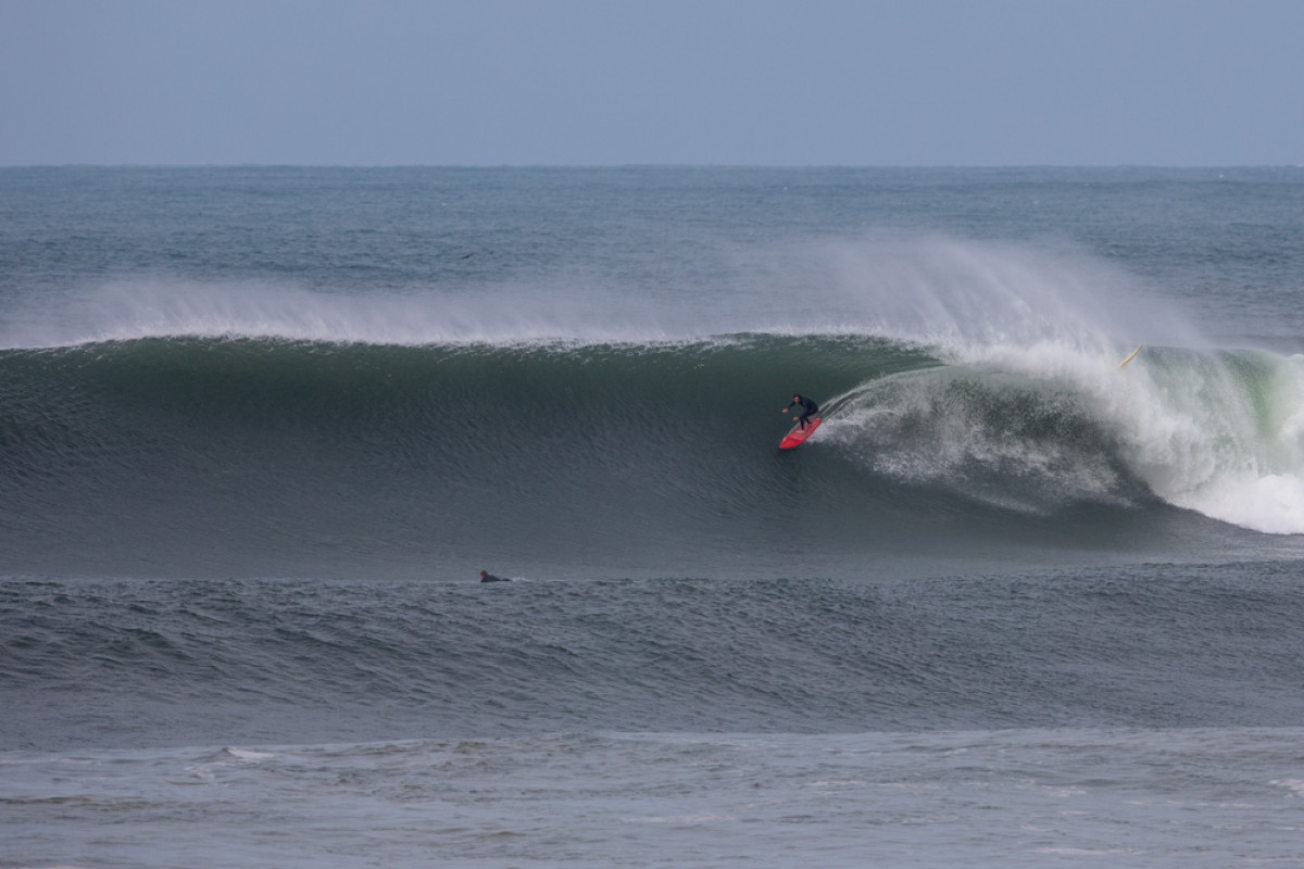
Surf Coast power, captured by Steve Arklay
Western Australia went a little quiet owing to that blocking high, while Tropical Cyclone Seroja did the Do-si-do with another smaller cyclone before tracking south-east and making landfall across Kalbarri, bringing widespread damage.
The surf improved mid-to-late month as a secondary 'bombing' low and significant follow up system sent large S/SW groundswells north where they met favourable winds.
With all the action in the Southern Ocean, the East Coast only saw episodic pulses of short-range and longer-range S'ly swells.
In SE Queensland and northern NSW, April kicked off with a tricky east and south-east swell mix, as a complex low drifted south along the coast. Noosa pumped as did Kirra, but overall, it was locations south of the border that faired best, raking in the southerly swell energy once the east swell faded.
Jay Wilson captured by Kane Brown at Noosa
We then move onto May, and yet another switch in synoptic setups where, like March, the southern states go quiet while Western Australia and the East Coast fire up.
Looking at May's Mean Sea Level Pressure anomaly chart, we can identify high pressure spreading across the south-east of the country, with a low pressure anomaly still there south-west of Tasmania, albeit weaker, and a strong high south-east of New Zealand with two dips - one into the Tasman Sea and the other north-east of New Zealand.

May Mean Sea Level Pressure anomaly
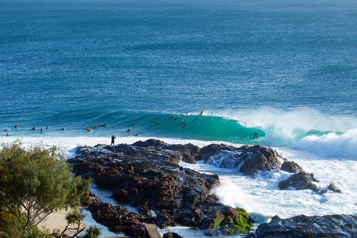
So firstly, looking at the East Coast we saw the easterly swell window open back up with a mix of trade-swell from the western Pacific Ocean and stronger groundswell emanating from a deepening, broad low in the Tasman Sea early in the month.
The beaches pumped across the south-east Queensland and northern NSW coasts with endless days of peaky barrels, while further south, things got serious into the second weekend of the month with large levels of E/NE groundswell and offshore winds.
It wasn't just the beaches that pumped. Mick Fanning from behind the rocks, captured by Andrew Shield
North-east Tasmania also faired well, with the swell lasting late into the following week ahead of a brief return to S'ly swell.
Late in the month we saw a tropical depression form into a significant low just north-east of New Zealand, generating a large E'ly groundswell to all East Coast locations on Tuesday the 25th of May.
This eased as trade-swell padded out the rest of the week ahead of another, less consistent E'ly groundswell which made landfall late Friday that week - though a large, building southerly swell episode was in full swing by then.
While the initial surge of southerly gales up the Tasman Sea last Friday and Saturday didn't provide much in the way of quality surf, it was a secondary intensification of severe-gale south-east winds (off the tip of New Zealand's South Island), projecting towards the country that provided the best surf.
A large, powerful SE groundswell made landfall on Monday, and along with offshore winds it sent pumping surf from Eden to the Sunshine Coast, tailing off slowly all week under light winds, bringing us up to today.
The southern states saw plenty of swell into the first half of the month, but winds failed to come to the party, being mostly onshore and strong out of the south owing to that high pressure anomaly sitting across South Australia. The end of the month offered better waves across most locations with fun swells and a shift to northerly breezes.
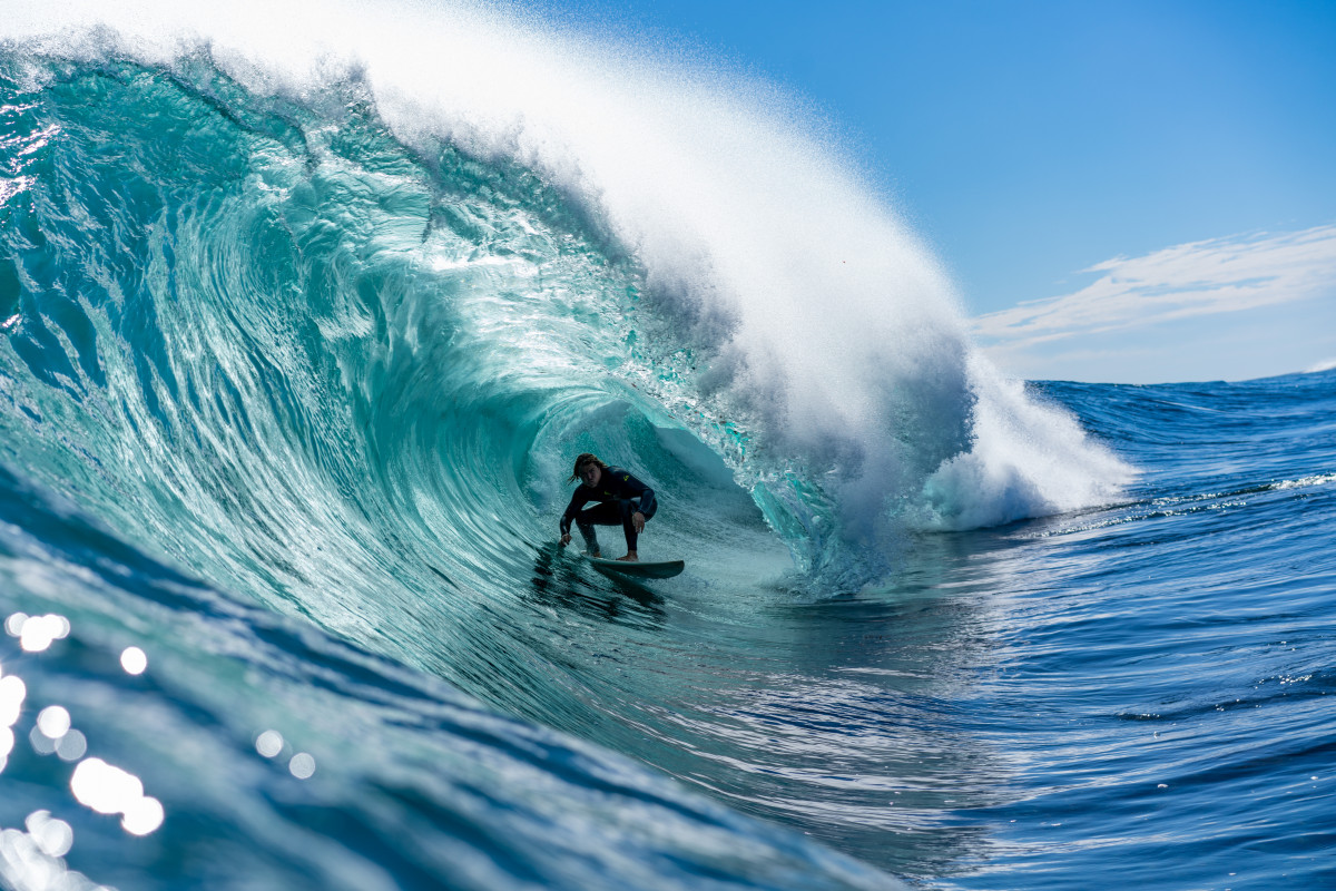
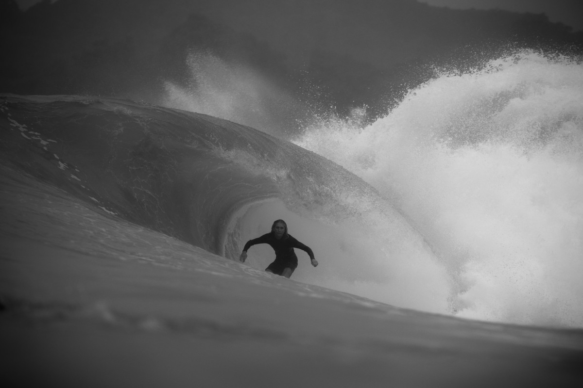
Autumn magic in West Oz. Keegan Kelly deep, captured by Matt Macdonald
Margaret River saw slightly longer-range swells from storms firing up around the Heard Island region, then pushing east-northeast, generating large pulses of swells and with favourable winds due to a semi-permanent high setting up west-southwest of the state.
Which was lucky for the Wozzle, as they scored great surf for both events, while the energy has dimished since they left town.
Just to finish off, if we look at the three months of autumn as a whole we get the image below.

March/April/May (autumn) Mean Sea Level Pressure anomaly
We can identify the low-pressure anomaly spreading south-west to south-east of Tasmania, supporting high east of New Zealand and lows north-east of New Zealand's North Island and in the Tasman Sea. But as explained and shown further above, the monthly breakdowns give a much greater idea on how the season played out, with periods of pumping surf mixed with average to poor conditions month to month, region to region.
Comments
That rain event fooked the banks and then they finally came back then last weekends massive south swell hit.......haven’t seen what’s left yet
pretty damn good, real mixed bag as far as quality goes.
Shaded by last year but for mine it was the extended E swell at the start of May that extended into Mothers Day weekend that had the best bang for buck.
Nice one Craig.
Great article Craig. Have u got long term outcomes? Think sa did alot better than u reported but I think I'm comparing it to the worst spring/summer on record. Keep up the great work.
Narrabean had great conditions? Great conditions, shit banks?
Great conditions but worst swell direction for Narrabeen
Always interesting to see how the data matches up to the anecdotes.
We went north mid-April and it took a while for the swell to materialise, meanwhile down south I was told that it was 4ft plus for almost 2 weeks straight.
But crikey, that run of east trade swell at the start of May was completely mental where we were. Saw some of the most perfect waves of my life.
How good!
Any ideas on how we can turn these pretty colour maps and hind casting into surf forecasting?
What is causing these patterns? How can we be in the right place at the right time?
What drives the surf conditions in different regions?
How can we better forecast what to expect?
I did one of these last year.. https://www.swellnet.com/news/swellnet-analysis/2020/09/29/seasonal-fore...
I've been keeping a close eye on the charts for this year, but without any major global climate signal developing It's hard to make any confident long-term predictions. I'll continue to research and produce articles when I become confident on more seasonal forecasts.
Also there are a few other articles here you might be interested in:
https://www.swellnet.com/news/swellnet-analysis/2015/08/05/el-nino-and-a...
https://www.swellnet.com/news/swellnet-analysis/2020/06/25/analysis-la-n...
https://www.swellnet.com/news/swellnet-analysis/2020/08/20/la-nina-alert
https://www.swellnet.com/news/swellnet-analysis/2017/06/29/western-and-s...
Love your work Craig! Thank you for sharing your research mate.
It's interesting that we are quick to put a label on things: La nina, el nino, SOI etc. What I am getting at is these are "symptoms", but we want to look for the "causes".
Our oceans are massive storage pools of energy. They release this energy in certain directions at certain times.
For example, on the east coast of Australia, we know with relative certainty that cyclones usually occur during summer months, and that the southern oceans are most active and produce their biggest swells during the winter months.
Why?
What drives this?
We know wind creates waves. We know the sun's rays hitting the earth causes the wind to blow.
What are the bigger cycles going on that determine why one summer is more active than the next? Why Tahiti has bigger south swells some years than others? Why did that mega swell hit Cloudbreak for the Volcom comp? What caused that huge swell?
This stuff is not random. Nothing on our planet is random. It is all part of cause and effect. Every action has an equal and opposite reaction, therefore every big storm and swell was caused by something.
What is it guys?
We are an informed bunch of ocean addicts.
Can we put our heads together and maybe share some ideas about what makes the oceans tick?
Do we have any astronomy students or experts amongst us? What about the planetary cycles? do they have anything to do with it?
Imagine if we could pick the best month of each year to be in Indo. Or whether this season would pump in Hawaii. Well in advance.
That is the type of forecasting I am into. That's the info we are all after.
Lets put our heads together, and hopefully come up with some meaningful outcomes.
Solar flares? Maybe too simple, but..??
And yep, great work Craig and great conversational point and observations Troppo.
Weather/complex systems have a quality called chaos. Have a look at these videos by Derek Muller.
You get to a certain point where it is impossible to predict
Wow, incredible videos Lampy, cheers!
They are great hey, super interesting. He does some other great videos. Maybe chaos in weather could be a good article you could write? Has to be some good papers out there on the subject
thanks lampy. Most interesting lunch break I've had in a while! His comment on the inaccuracy of the 8 day weather forecast was really interesting. I've been thinking lately the only thing you can take from that forecast is that it will be completely wrong. If that's true, maybe it can be useful!
Well it depends on what you're looking for. Say an exact wind/temperature/rain/swell size 8 days out, for some locations for sure it's likely to change, but for general trends and an idea on the timing, size and local conditions when an expected swell hits, it's very useful.
Remembering also that the travel time for some swells can be in the order of 3-5 days, even more across bigger ocean basins, you can be fairly confident on certain swells easily over a week out, even nearly two for some spots, and the general pattern two weeks out.
Good point regarding the timing of swells. I was just referring to the local winds. My feeling (no science behind it!) is that occasionally the weather systems seem to be on rails and the long term winds have a lot of room to move to get it right, for example the current westerly pattern, but in general a slight miss on the timing of a southerly change throws the wind forecast out completely. Anyway it’s all just speculation from me.
I think the La Niña pattern was very well signposted and accounted for.
No surprises there.
A pretty stock standard autumn for this part of the world.
Putting my neck on the line in this forum, but I would hazard to say that it was above average further north (QLD), due to the number of swells with more east in them. with enough size to be good everywhere, but not too big to be points only... spent most of the autumn within a very small radius of home.. last year had more south focused swells with smaller waves overall in my neck of the woods.
happily surfed out from the last 6 weeks...
Agreed, crazy-good run of East swell for the beachies.
I just hope the banks recover coming into Winter, otherwise it's going to be a very long haul through shitty stormbar outer banks at low tide and inner shorey high tide banks right through winter and into early Spring. Mid tide has fck all options at present.
Don't we all say that before/after each and every major swell event though?
Always seems to be a lot of discussion around bank busters, but it doesn't always happen. And even when it does, sometimes it improves very quickly.
Certainly happened on the MP. Banks completely destroyed by a succession of two giant swells and raging onshore winds. Just starting to see some semblance of banks now. Anything which had a rock ledge near it was turned into a diving pool and still is.
There was also the tide routine this year with the monster lows falling in the morning and evening for the last few months which mostly coincided with decent conditions. Has been driving me mad
Better than average but not incredible, too much period, certainly had it's moments though.
Great report Craig what a sick 9 days of point waves up here until yesterday the sand got better by the day
I always think it weird when surfers say good conditions, but no swell.
What are those conditions. Good offshore wind, and ??? Unless your worried about the weather, it should be good winds but no swell. Thank you, rant over.
Well surface conditions are the conditions, regardless of swell.
It can be clean, glassy, smooth and good. Or choppy, lumpy, bumpy or morning sick which is bad.
That's regardless of what the swell underneath is doing.
I agree with that division Craig.
"Conditions" are idependant of swell in my appraisal.
We had a year of no banks after the 2016 black nor-Easter swell.
Bank busters are a very real thing.
There's a wife pun in there somewhere.
Lol Sprout.
My wife is the opposite though.
Tighter than a nun's budget.
Was only talking about the local banks getting trashed by big long period ,chunky swells the other day . The previous swells with ENE direction killed our local . Then the last swell seemed to fix it all up .
Its got me stuffed how that happened , but it was a SE direction here .
Then I came out with a bold statement about being done with beach-breaks . When you think about it , most of the true quality waves you get in life are over reef or along a point break .
Windy, sweepy, big waves with short period energy seem to be what trashes my local. Stormy conditions that create the gutter and storm banks. Pretty much in the same category as Don's sweep discussion, long shore drift etc.
Don't think we'll ever be able to predict months ahead the swell forecasts as the swell produced systems have behavioural mind sets like humans (unpredictable).
Better chance at curing cancer.
Here Here
yeah, agree with Lampy above.
chaos is an intrinsic quality of the ocean/atmospheric system.
So good to hear your inputs!
Many think we live on a planet governed by Choas.
Chaos is the term we defer to when we do not have the answers.
Instead of saying "I don't know", we send it off to chaos theory.
What a wild world.
It's actually a lot more predictable than we think.
Summer is warmer than winter. Why?
That alone gives us something to work off.
When was the last August cyclone in Australia?
If chaos rules, we would have at least a few.
Patterns are playing out here. And it's interesting to me as a subscriber that you guys don't event have a handle on what creates swell or big wind.
This stuff can be predicted years in advance.
Crazy additional input. Why don't WSL have pipe masters in June, and run Snapper Rocks comp in October / November?
We all know kirra pumps in November, and Pipe is epic in June.
Hahahaha.
not sure what you are saying Troppo.
We understand seasons perfectly well.
we also have basic understanding of some ocean/atmos cycles like the ENSO cycle and the IOD.
within that though there is considerable chaos involved in predicting individual systems.
They can't be predicted years in advance.
Do you have a different view?
I'm not sure I'm understanding you correctly.
I'll put something together and get it through to you for a look.
It's a bit left field, but has helped me predict swells with reasonable accuracy for a while now.
sounds interesting.
I agree to a certain extent that yes there’s heaps more to learn and we’ve only discovered the tip of the iceberg
But you’ll never get the accuracy you’re talking about and here’s why
All weather is born through uneven heating of the earth. How do you know if I will remove my Jacaranda from my backyard and build a granny flat, if I don’t yet? No shortage of other events impacting the outcome too. Think about the year long heating above bushfire zones, very different to what would have happened while there was a green canopy
As I’m only one of 8 billion, then it’s clear there’s plenty of room for chaos...
Troppo, chaos theory is the theory that there is no chaos. It just looks like that sometimes.
Chaos theory - “that apparently random states of disorder and irregularities are actually governed by underlying patterns and deterministic laws that are highly sensitive to initial conditions.”
Reasonable accuracy? Lol. Here's one I use and its pretty accurate..." Its been shit for so long,maybe it'll be better soon"
Northern NSW: Distinct lack of NE wind events and associated upwellings throughout Summer and Autumn. Lots of current and warm/hot water in close. Rain that usually fell out to sea on the current, fell on the coast. Great season for pelagics off the rocks, out of kayak is far too easy!!!
half your luck, water was mostly too dirty inshore here for pelagics off the rocks.
3-4 weeks of mud but fired either side. Had Tuna frothing in dirty water, lots of smaller fish as well <8kg which we don't usually see. Small pods of big fish yesterday, lots of bait and 2-3m Whalers!!!
I reckon that most of the time the dirty water was just sitting on top of decent stuff underneath. Plenty of Spaniards kicking around when it was proper putrid to look at from above. As I said before, I got a decent Wahoo in 25m of water that looked like kava on the surface. Pulled tuna out of the same water regularly.
Still over 23 degrees not far offshore here. Was down Illawarra over the weekend and the water was surprisingly warm. Crew down there have been doing well on yellowfin.
My random punt shows our southern swell window firing up from June 24 to at least the end of the month.
This stab in the dark is based on zero looking at models etc. Just on a few old fashioned fisherman indicators.
Let's see how it goes!
At least I'm game to put it out there...
6 days of S swell at the end of June?
that ain't Nostradamus stuff mate, with all due respect.ed
you need to give the indicators so we can reference them against observed reality, to see if there is correlation.
could you do that?
Point taken. But considering I got a new board a week ago, and it still hasn't been in the ocean, plus the fact we have nothing noteworthy in the following week, it ties in nicely to my model.
The WAMS etc are not showing anything of note, so i am going against the model trend. This is not simply following the pretty colours on the swell charts.
What would Nostradamus do mate?
Since I stuck my neck out in Craig's original article, I've been busy putting my last eight years' diaries into an excel spreadsheet to hopefully share with you guys.
More work than I expected.
But in answer to your comment, I have given indicators, that being south swell windows lighting up from June 24 for a week, go with that.
South swell, not east!