Coastal Creationism - Part 11: Island life
The word ‘island’ is probably the most evocative in geography. The mere mention sees people start thinking about somewhere far removed from their daily travails. The islands of our imagination are idyllic, tropical, and invariably have pumping waves. Of course we know our watery blue planet is dotted with myriad islands, and some of these do fit the ideal - they're warm and they're ringed with great surf. Yet many others aren't; they're cold, surrounded by steep cliffs, and host nothing that resembles a rideable wave. So what's the go? How are islands formed? How does the type of island affect its potential for good surf? And just what is an island anyway?
Considering the last question, islands are land surrounded by water. But then so is Australia so why is it a continent? The distinction between continent and island is a little bit arbitrary but the key difference is that continents are tectonically independent. That is, they have their own major tectonic plate. The Australian continent is mainly comprised of thick, ancient continental crust. It's separated from the Asian, Pacific, and Antarctic plates. Whereas Greenland - the next biggest island - is an island because it still part of the North American continental plate. Yes, there are plenty of microplates like the North and South Bismarck Plates north of Papua New Guinea. However these islands don't get to be continents because they are too small and lack the thick, ancient continental crust.
Before we get too far into the surf potential of islands, we need to step back and try and group islands into categories. These categories will relate to how they are formed and where they are located. This in turn provides a basis for the types of reefs and waves that can be found (or not).
Generally Islands are grouped in to six main categories. These can be divided in to sub-groups depending on the different processes forming the island.
1. Continental islands: These islands are part of the continent that has been separated from the mainland by rising sea levels (Tasmania, Kangaroo Island, Groote Island) or by parts of the continent breaking off (New Zealand, Madagascar).
2. Tidal islands: These are islands at high tide only, usually connected by a sandpit (Green Island NSW, Fingal Island NSW).
3. Barrier islands: These are formed when sediments pile up offshore, creating an island separated by a lagoon or sound from the mainland. Sediments can be sand or even coral and carbonates. Examples of sand barrier islands include South Stradbroke Island. Looking back at Coastal Creationism 5, it explains how Rottnest island and the offshore reefs are also barrier islands made from carbonate reefs and sands.
4. Oceanic islands: These are the islands that we most likely think of as idyllic. Oceanic Islands are tips of volcanoes protruding above sea level. There are two main types of volcanism creating oceanic islands: hot spot volcanoes such as Hawaii, and island arc volcanoes over a subjecting plate margin such as Bali and Lombok. There are so many interesting things happening in oceanic sslands that we will dedicate an entire article in the next Coastal Creationism.
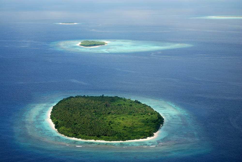
5. Coral islands: If your idyllic island was not oceanic, chances are it was a coral island. Of course the two often go together - but not always. Coral islands are formed by corals growing toward the light at the sea surface. Broken corals can pile up forming a sandy cay such as Lady Elliot Island or Tavarua. A ring of coral islands and barrier reefs is an atoll.
6. Artificial islands: Artificial islands are all the rage these days, ever since China decided to turn some disputed sandbars into massive defence bases, described by some as "unsinkable aircraft carriers". Of course Dubai got busy with artificial islands as a form of property development speculation, such as The Palm and The World. As far as we know there has been no effort made to create artificial surfing reefs to compliment an artificial island, yet!
So let's start exploring the surf potential for the various types of islands.
Firstly, what's the best thing about islands? One side is always offshore! We know this doesn't always help, but sometimes it makes things very interesting. For example, a trade wind swell doesn't do much good for islands in the trade wind belt. If there is good exposure to the shorter period trade wind swells, then they're also well exposed to the trade winds themselves (ie: directly onshore). Unfortunately ducking around the corner doesn't help a lot as shorter period windswells won't wrap onto the lee side of the island. However, if the swell is a longer period ground swell from a distant source, chances are it's either a good direction or will wrap some of its long period energy on to a coast on the lee side of the island. In really outstanding examples, a long period groundswell can wrap around both sides of the island and come together as wedging A-frames on the offshore, lee side of the island (think Bass Strait).
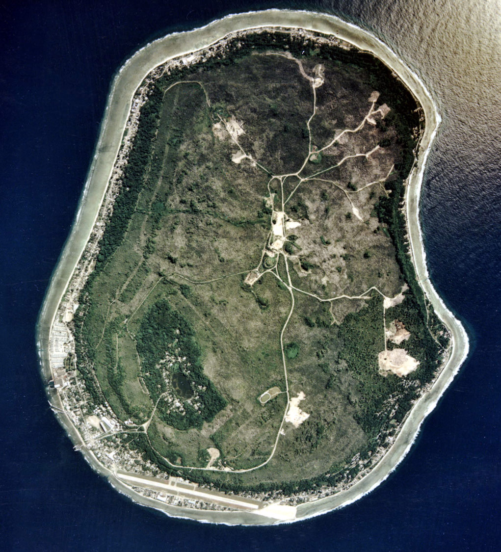
What about things that don't help make good surf? There are plenty of well positioned islands that are entirely lacking in decent waves, such as Christmas Island and Nauru. Despite the presence of Australian immigration detention centre on both these two islands, it is not the reason that they lack for good surf. The other Australian immigration gulag, Manus Island actually does get excellent waves and disproves the theory.
Christmas Island and Nauru are a bit similar in that they are both oceanic islands, the tips of volcanic seamounts rising from great depths. They're in great locations to get swell and they're surrounded by fringing reefs. However, the reefs seem unable to handle a decent swell, the reef is so abrupt that deepwater swells are tripped into a collapsing or surging wave, rather than our preferred plunging wave (see Coastal Creationism 1). Interestingly, Christmas Island is largely made of limestones from fossil reefs, stacked in layers - described as being a little bit like a wedding cake. The volcanic rocks of the seamount are generally a deep basement and don't form any of the surfing reefs.
 Nauru is kind of similar, except that much of the rock above sea level was phosphate from guano (read: bird shit). The sea birds crapped huge amounts on the island over the eons, this was later discovered to be an excellent fertiliser and was mined extensively, generating a mining boom. Now there is very little phosphate left and Nauru has gone from the richest country per capita to almost broke. Again, the fringing reefs tend to be abrupt and lacking in the convex curves or ramps that create good plunging waves.
On oceanic islands there is a delicate dance between the island subsiding, the coral reef growing up, lagoon flows, freshwater, and turbidity that helps shape the reef. When performed with subtlety and refinement, epic reefs result. However a few sharp missteps and you end up with a jagged, waveless rock in the middle of the ocean.
Consider that it is only 400km from Panaitan Island south to Christmas Island. One island has some of Indonesia's most epic waves, the others main claim to fame is that it gets overrun by red crabs! Despite their proximity to each other, there's obviously something different about the islands.
In the next Coastal Creationism we will look at the different ways that Oceanic Islands form and what that means for surf potential.
Coastal Creationism is an ongoing series written by Chris Buykx. Chris is a geologist, traveller and lifelong surfer. Specialising in eco-tourism, his passion is interpreting nature and the environment. Chris is a resident of Sydney’s Northern Beaches.
Click here to visit every instalment in the Coastal Creationism series.
Comments
This series has become all the more interesting for me recently as I've been studying plate tectonics in science. I was wondering, that if a plate is moving due to continental drift, and more on one side than the other, could this over a few decades slightly alter the peel angle of some reefs and points? It's certainly interesting, and maybe in 100 years our famous refs may be changed, but old ones may become new. Really makes you appreciate good waves when you know about them.
I hope that earthquake off Sumatra tonight jolted Cocos 30 degrees off axis
Timely discussion, thankfully early reports suggest they have dodged a bullet.
I am writing next weeks article now and will devote a lot more to the processes at work in subsections zones and island arcs.
How about Tonga? Compared to other South Pacific islands it seems to lack any epic surfing reefs, though my understanding is that depending on the swell direction the NW tip of Tongatapu produces peaky hollow lefts or right (which is also offshore under the trades).
Same for the Cook Islands too.
@Chris I hope you do an in depth look at the outer islands of Sumatra at some stage, the whole island chain is similar in some regards but also very different from area to area (even just the Mentawai's) also a very interesting place due to the volcanic/plate influences, most likely the most ever-changing surfing reefs in the world.
Good point Ben, I went over during our winter for the lefts. Charts were reading 3-4 metres. My biggest board was only 6,7 so got anxious expecting 8-12 ft Fiji style , instead we got 3 days of 4 ft average lumpy, 2 days of perfect 3 ft and skunked 7 days watching swell go straight past to Fiji. Why ? Angles to swell or too deep the Tonga trench, interesting understanding how the bathymetry, etc all works. Gonna try Jan/Feb NW Swell 1 day. Too many more reliable swell places to travel though.
I am not sure what is happening in Tonga as i haven't surfed there yet. However I suspect it has a similar problem to Christmas Is. and Nauru. That is the reefs are too abrupt. The haven't formed the ideal ramps or lozenges we are looking for. I don't think the depth of the Tonga Trench is an issue as many other good waves have extremely deep water nearby. I suspect its all about the bathymetry in the last 100m and especially the last 30m. If the reef drops off without any sort of ramp or tongue of reef at a gradual slope in the 30m range then there is a high risk of surging waves rather than our preferred plunging waves (i.e.: barrels!) My cursory investigations show that Cloudbreak is very unusual with a well defined reef as a tongue out to 30m or more, spread over about 700m of lineup. Most other atolls seem to be a lot sharper/steeper than this, hence lack of good waves.