Good run for the Surf Coast
Wednesday, 9 July 2025
Good run for the Surf Coast
Wednesday, 9 July 2025
The coming period is fun for the Surf Coast with moderate sized swells, possibly increasing mid-late next week.
The coming period is fun for the Surf Coast with moderate sized swells, possibly increasing mid-late next week.
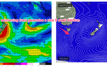
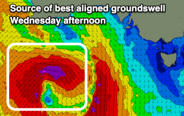
Compared to Mondays notes the outlook for S swell is improved, mostly due to a better aligned following front which conjoins the initial front and forms a slower moving low in the southern Tasman.
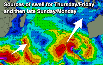
As the frontal activity moves east, we'll see improving conditions mid week and the chance to take something out of the easing swell.
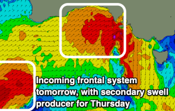
Back up again Thurs from the E-E/NE as winds feeding into the low strengthen before slipping behind NZ.
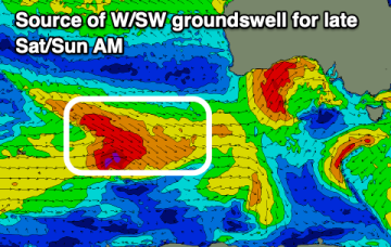
The coming period is generally small with tricky west swells on the cards.
A strengthening frontal progression is moving in from the west and will hit tomorrow morning.
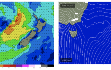
High pressure is well up over the centre of the continent with as weak, troughy area of low pressure moving offshore from the south coast dragging a cloud band with it and offering a W’ly flow in it’s wake. That W’ly flow looks to continue through the working week as a series of cold fronts sweep across the SE of the country.
High pressure is well up over the centre of the continent with as weak, troughy area of low pressure moving offshore from the south coast dragging a cloud band with it and offering a W’ly flow in it’s wake. That W’ly flow looks to continue through the working week as a series of cold fronts sweep across the SE of the country.
The Surf Coast will be the pick over the coming period with fun levels of swell and mostly clean conditions.