A couple of options on the beaches
Monday, 4 July 2022
A couple of options on the beaches
Monday, 4 July 2022
Out of season winds and average swells but there'll be windows of fun waves across the beaches.
Out of season winds and average swells but there'll be windows of fun waves across the beaches.
Small amounts of E/NE swell will build later Mon, into the 2ft range as a Easterly trough low forming off the Sydney coast remains slow moving over the weekend.
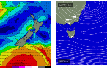
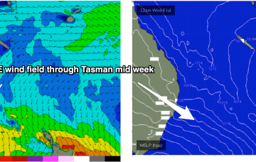
By Wednesday it looks like a classic La Niña map. Strong high just SE of Tasmania with a low in the Central Tasman directing a huge windfield through most of the Central to Northern Tasman Sea.
By Wednesday it looks like a classic La Niña map. Strong high just SE of Tasmania with a low in the Central Tasman directing a huge windfield through most of the Central to Northern Tasman Sea.
Plenty of surf days this period, strong Monday morning.
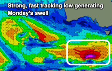
Favourable winds and a large, powerful W/SW groundswell for the weekend.
OK, here we go. We are starting to get some model agreement on a developing easterly trough low expected to form off the Sydney/Hunter coast through tomorrow. There’s still a degree of uncertainty as to the exact position of the low axis, which will make wind f/casts a bit rubbery and really, coming down to a game of kilometres.
Winds are looking good for the South Coast tomorrow before the south-easters kick in, improving mid-next week.
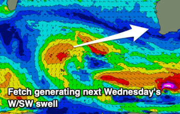
There's plenty of swell inbound but winds will spoil most of it until mid-next week.
A complex trough spanning much of the East Coast will develop over the next few days, of which the latest model guidance is pointing towards a significant easterly trough low (that may become an ECL) slowly evolving from Saturday through the first half of next week.