Improving week of winds and surf
Monday, 4 August 2025

Improving week of winds and surf
Monday, 4 August 2025
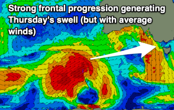
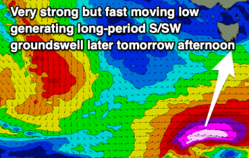
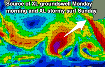
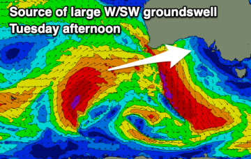
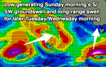
A large W/SW groundswell is due tomorrow but with onshore winds across the Mid Coast. Improving winds and another large SW groundswell is due later week.