Fun Mid Coast swells, trickier weekend
Monday, 11 August 2025
Fun Mid Coast swells, trickier weekend
Monday, 11 August 2025
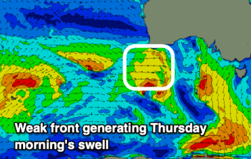
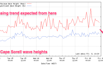
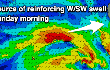
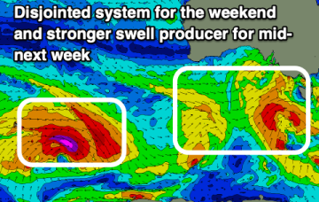
The coming week will be small to tiny on the South Coast, best across the Mid Coast working the winds. A trickier weekend is due to play out.