A whole week of westerly gales, with one solid surf day
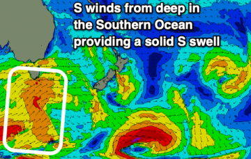
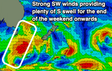
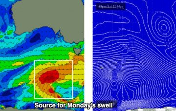
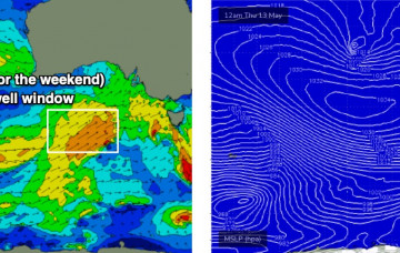
A polar low pushing along the ice shelf under South Australia on Saturday is expected to line up nicely within our S/SW swell window.
The magic run of E swell will come to an end as a series of S swells move up the coast.
The last of E swell will fade out into tomorrow (Saturday) before a series of S swells fill in.
A vigorous front will pass south of the state overnight, renewing gusty SW winds across the region - though they’ll ease steadily into the afternoon.
A vigorous front crossing the coast tonight (due into the Surf Coast between 1-3am Saturday) is unlikely to offer a brief window of early W/NW winds west of Melbourne, the timing’s simply too tight.
A high pressure system to the south of the state and a deepening trough well east of WA will maintain moderate to fresh E’ly winds across the region.
Check the forecast graph - we’ve got ten consecutive days of windy conditions coming up, initially related to an amplifying Long Wave Trough steering a succession of vigorous cold fronts across the state.
Saturday looks to be post-frontal in the wake of Friday night’s change, whilst Sunday morning will see generally light variable winds as another front approaches from the south, bringing moderate W/SW winds into the afternoon.
We’re at the cusp of five days of windy conditions as an amplifying Long Wave Trough steers a succession of vigorous cold fronts into the Victorian coastline.
The last of the E swell will fade into the weekend before S swells make a return.