S swells returning as E swell fades out into the weekend
South-east Queensland and Northern NSW Surf Forecast by James Casey (issued Wednesday 12th May)
Best Days: Thursday, S swell peaking Sunday and then again on Wednesday
Outlook:
- E swell to hang in around the 3ft mark until tomorrow, smaller for the MNC
- E swell will fade to 2ft on Friday smaller on Saturday with offshore winds in the morning
- S swell to move in on Sunday with strong S winds, biggest south of the border up around the 4ft mark for S swell magnets
- Offshores return for the start of next week before another S change moves through late Monday bringing S/SE winds into the middle of next week and a larger S swell up around 4-6ft south of the border
Recap
Early offshore winds and 3ft surf, there’s been plenty of options over the last few days. The afternoons have seen a seabreeze puff up out of the NE creating a bit of bump.
South of the border winds have been a bit better, remaining light and variable, mainly out of the W, for most of the day.
Today waves will remain around that 3ft mark with SE winds pushing in later in the afternoon but remaining light.
The rest of the week
The E swell will fade into Saturday as the ridge directing all the E winds over the last week and a bit breaks down.
Tomorrow (Thursday) will see SW winds early with a seabreeze in the afternoon. Waves will remain around that 3ft mark as the final pulse of E swell fills in into the afternoon.
Friday will see waves drop to 2-3ft with winds SW early but tending more S/SE later in the day. South of the border a new S swell will begin to fill in thanks to strong winds to the east of Tassie and out of eastern Bass Strait. There won’t be much size until later in the weekend though with a mix of E and S swell on offer.
The weekend
The E swell will fade into Saturday as the S swell starts to gain some momentum late Saturday afternoon for south of the border. I wouldn’t expect much more than 2ft waves with the last of the E swell as the trade setup finally comes to an end.
Sunday will see a S swell move up the coast peaking around the 4ft+ mark at S swell magnets for N NSW and the MNC. It won’t fill in for most of SE QLD due to the acute angle of the swell d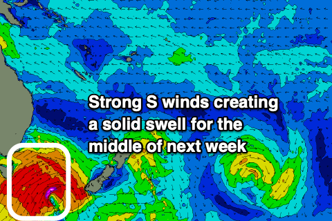 irection.
Winds will be out of the W/SW for most of Saturday strengthening and becoming more S/SE on Sunday.
Next week
Offshore winds will return for the start of next week under a ridge of high pressure although a S change will make its way up the coast with the MNC getting windy by the mid morning, N NSW by the afternoon and SE QLD by the evening. These S/SE winds will continue into the middle of the week with SW winds early in the morning.
Waves will ease on Monday before a larger S swell builds Tuesday into Wednesday reaching a peak of 4-6ft for N NSW and the MNC. SE QLD will fare better with this second S swell due to it having a bit more SE in it. Still it’ll be a fair bit smaller than south of the border.
Tune in on Friday for an update.
Comments
hey james, not meaning to question your forecast, but all the wind models i have looked at for the GC tomorrow (thur) suggest westerlies all day. your forecast says an afternoon seabreeze - how sure are you on that? (planning an arvo surf)
Just to pick up on this - the synoptic flow is weak, so we're seeing different winds across different parts of the coast. The Seaway is still W/NW but the NE breeze actually kicked in around 10am in Cooly (classic forecasting scenario too - was the outlook correct? Anyone north of Burleigh says no, anyone south of Palmy says yes).
Elsewhere, the Sunshine Coast is E/NE, the new AWS off Bribie Island (North West 10 Beacon) is S/SW. South of the border, the remainder of Northern NSW is W/SW but Coffs is S/SE.
So, a pretty wide variety of wind directions, though everywhere is generally at 10kts or less.
Totally agree. Onshore mid morning in cooly, but westerlies all day where I went. Pumping too.
south kingy was light E/NE by 10am and had bumped up surface conditions by 12pm..conditions were sublime before the ruffle set in and tide went out too much though
Fun waves with no one around on open beaches on SC today.
Surfing in boardies!
Hoping for similar tomorrow.
How good is May??? Magic May!!!
Yeah was real good this morning. A decent crew at my local but little hassle.
Tomorrow looks like early southwesterlies, so maybe not ideal for the wide opens.
We’re you ripping though ?
Getting tunnels with the bois ?
Yesterday was unreal on the GC opens, got a solid 27 minutes in after work.... Unfortunately, it hasn't followed through this morning.