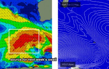
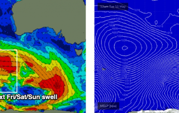
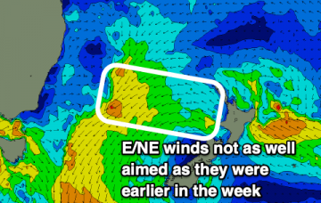
E swell fading into the weekend, S swells return
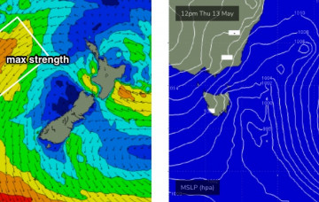
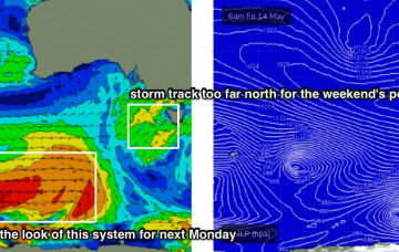
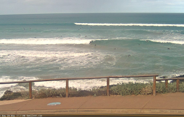
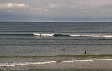
Last of the E swell to fade into the end of the week while S swells make a return for the weekend.
The broad scale forecast trend is relatively straightforward, as we have one significant swell event due Thursday, and then a steady easing trend for three days thanks to a blocking pattern.
Today’s southerly change is expected to stall off the Southern NSW coast as a trough, and then reorientate nicely within our swell window.
The final front/low in the Southern Ocean sequence is expected to track below WA on Friday, and as it’ll hug the ice shelf, will be much better positioned within the South Arm’s swell window.
Another pulse of E swell will bring some more fun days of waves this week.
Freshening NW winds and temporarily small surf at Victor on Thursday morning will precede a gusty SW change during the day, associated with the first in a series of strong fronts push across the region, tied in with an amplifying Long Wave Trough.
The next few days look a little tricky. Then a strong frontal progressions from late Thursday onwards.
A smaller E swell will continue into the new week and with winds remaining mostly offshore there'll be waves to be had.
This morning’s new swell is really the centrepiece for the weekend.
A polar low developing off the ice shelf on Sunday (well below SA) is better positioned for a swell increase across the South Arm.