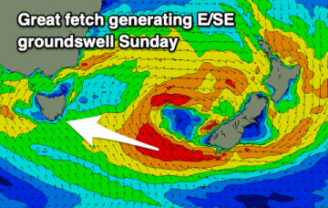
Rare E/SE groundswell
Friday, 8 July 2022

Rare E/SE groundswell
Friday, 8 July 2022
Poor tomorrow but better Sunday with a rare E/SE groundswell and OK winds.
Poor tomorrow but better Sunday with a rare E/SE groundswell and OK winds.
Building wind and surf on the weekend, largest Sunday afternoon but improving quickly while easing Monday.
Improving tomorrow with a mix of swells, best Sunday with easing size. A windy change is due Tuesday with some new westerly swell.
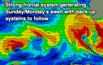
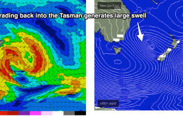
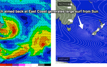
The new trough/low is generating gales out of Bass Strait and up towards the South Coast. The main low is drifting towards the South Island and intensifying today, with gales to severe gales expected to retrograde NW back into the Tasman Sea (see below), generating a large swell for Sun/Mon.
The new trough/low is generating gales out of Bass Strait and up towards the South Coast. The main low is drifting towards the South Island and intensifying today, with gales to severe gales expected to retrograde NW back into the Tasman Sea.
The main low is drifting towards the South Island and intensifying today, with gales to severe gales expected to retrograde NW back into the Tasman Sea.
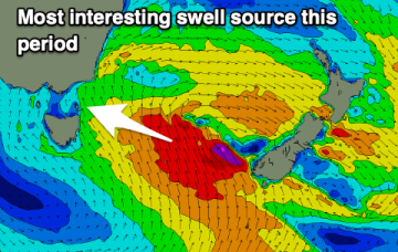
You know things are off when we're more interested in swell arriving from the south-east.
Easing S/SW swell ahead of building south-east energy but with onshore winds. Sunday will become cleaner.
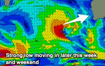
By Friday the low will have moved towards the West Coast of the South Island, where it intensifies again, generating strong surf for East Coast Tasmania.
Make the most of the current surf before things deteriorate later week and through the weekend.