Upgraded outlook this week as low forms off Mid North Coast
Monday, 3 April 2023

Upgraded outlook this week as low forms off Mid North Coast
Monday, 3 April 2023
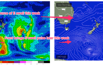
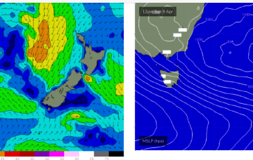
This will direct an E’ly fetch across a wide swathe of the Eastern seaboard from the sub-tropics down to the Sydney region. A small closed low forming in the trough then slowly retracts eastwards as we head into the Easter weekend. Winds are going to be a bit tricky but we’ll have plenty of E/SE-SE swell to play with this week as this fetch forms up.