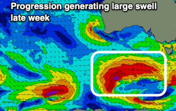
Another large swell to end off the week
Wednesday, 31 May 2023
Another large swell to end off the week
Wednesday, 31 May 2023
We'll see large surf developing through tomorrow afternoon, cleanest and easing Friday.
We'll see large surf developing through tomorrow afternoon, cleanest and easing Friday.
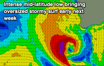
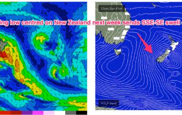
There's nothing that stands out this period with an oversized, stormy swell for early next week.
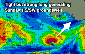
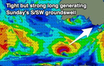
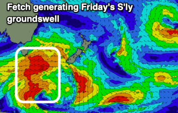
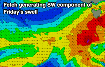
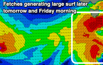
We'll see a S'ly change and large building S/SW swell tomorrow, easing Friday ahead of one final strong swell Sunday. Winds will persist out of the north-east.
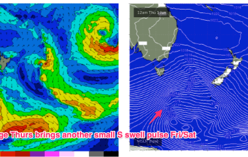
We've got a large swell to end off the week with average winds tomorrow, much better Friday. The weekend and next week will be dominated by east to north-east winds though with one final significant groundswell.
Very wintry looking synoptic chart as we exit Autumn with a large high moving in over the continent with active cold fronts tied to low pressure systems tracking into the Tasman Sea. That pattern will extend through most of the week before a high cell drops into the Tasman Friday, with stronger frontal activity expected over the weekend and into next week
Friday looks the pick with some east potential for next week.
Very wintry looking synoptic chart as we exit autumn with a large high moving in over the continent with active cold fronts tied to low pressure systems tracking into the Tasman Sea. That pattern will extend through most of the week before a high cell drops into the Tasman Friday, with stronger frontal activity expected over the weekend and into next week.
Southern Tasmanian Surf Forecast by Craig Brokensha (issued Monday May 29th)
Best Days: Tomorrow, Wednesday morning, Friday, Saturday morning
Features of the Forecast (tl;dr)
The coming week is flukey for surf while next week looks XL and stormy.
A good run for the South Coast with offshore winds and plenty of swell, though funky, troughy weather is due later week and into the weekend.