Easing surf ahead of a strong swell Sunday
Friday, 2 June 2023
Easing surf ahead of a strong swell Sunday
Friday, 2 June 2023
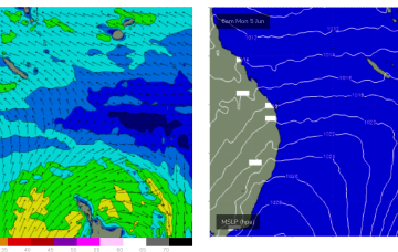
The wind outlook for Sunday has improved with a final, strong groundswell.
The wind outlook for Sunday has improved with a final, strong groundswell.
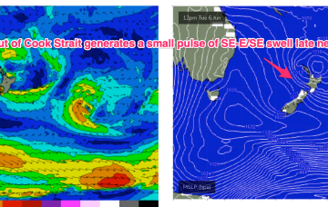
A new inconsistent swell with favourable winds is due tomorrow ahead of onshore breezes and oversized, stormy developing swell.
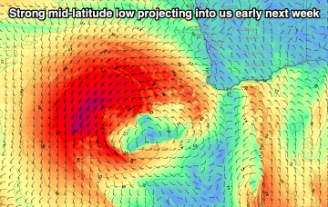
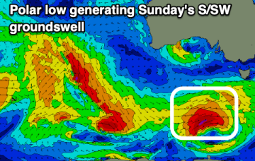
A front pushing aggressively NE into the lower Tasman on the weekend forms a low pressure centre which becomes slow moving near New Zealand early next week and this will be a co-main swell source for the week. The other source will be short range, peaky E’ly swell from a tradewind style fetch in the Southern Coral Sea.
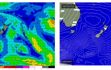
We've got a slower period of activity following Sunday's S/SW groundswell with the surf bottoming out through next week.
A front pushing aggressively NE into the lower Tasman on the weekend forms a low pressure centre which becomes slow moving near New Zealand early next week and this will be our dominant swell source for the week.
We've got a shift in weather patterns which will see the groundswells fading along with winds out of the north-eastern quadrant in general.
No great change to the f/cast with a high pressure ridge already building across the QLD coast and set to be reinforced by a much, stronger high which moves SE of Tasmania (summer latitudes) over the weekend.
Another powerful front with gales to severe gales pushes NE into the Tasman Sat into Sun with a strong pulse of S swell making landfall across NETas at S facing beaches on Sun.
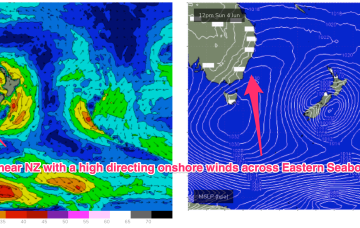
No great change to the current pattern with a large high sitting very far up (right up on the QLD/NSW border!) allowing free passage for cold fronts into the lower Tasman and a generally synoptic W’ly flow to continue across the region. Mostly long period S swell trains will continue to the be the dominant swell source until next week when a much more S’ly located high brings an onshore flow to most of the Eastern Seaboard. A trough of low pressure looks to briefly form off the Mid North Coast early next week before moving away quickly.
No great change to the current pattern with a large high sitting very far up (right up on the QLD/NSW border!) allowing free passage for cold fronts into the lower Tasman and a generally synoptic W’ly flow to continue across the region. Mostly long period S swell trains will continue to the be the dominant swell source until next week when a much more S’ly located high brings an onshore flow to most of the Eastern Seaboard.