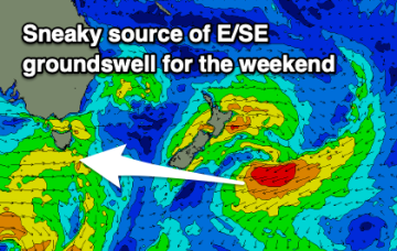
Unusual swell source over the weekend with NE windswell next week
Wednesday, 16 July 2025
Unusual swell source over the weekend with NE windswell next week
Wednesday, 16 July 2025
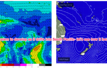
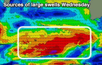
Tiny into tomorrow before a small kick in E/SE swell Fri from the low SE of the South Island which is currently on the edge of the swell window.