Fading east swells with dicey winds
Friday, 8 August 2025
Fading east swells with dicey winds
Friday, 8 August 2025
The large east swell will continue to ease as conditions remain less than ideal.
The large east swell will continue to ease as conditions remain less than ideal.
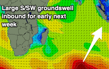
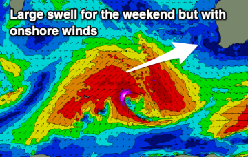
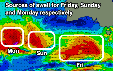
Two large swells inbound before things go quiet.
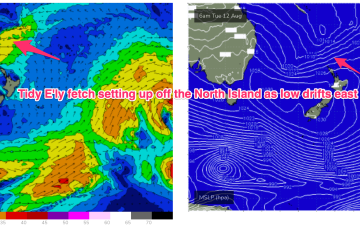
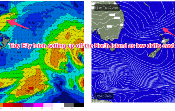
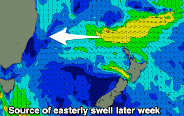
We should see some better quality, albeit small E/NE swell later next week from a new sub-tropical low which forms this weekend and then drifts out towards the North Island.
In addition another sub-tropical low is expected to form over the weekend, this time off the QLD coast before drifting off towards the east and reconsolidating near the North Island.
No great change to the f/cast for the week. The slowly retreating fetch is continuing to send strong E swells with just slow easing trend in play.
We've got an upgrade in the swell due Friday, tiny next week.
The coming period isn't great at all with smaller swells and average winds.
The coming days look good to great with plenty of swell and favourable winds.
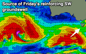
The wind outlook for the coming days has improved with back to back, solid swells. Winds will improve for the beaches but the size will stay elevated on the weekend.