Great outlook for the Rip Curl Pro
Monday, 21 March 2016
Great outlook for the Rip Curl Pro
Monday, 21 March 2016
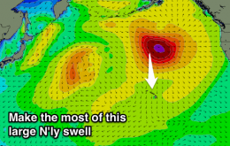
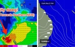
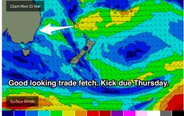
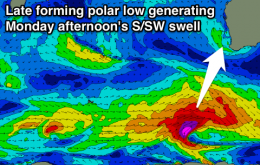
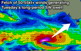
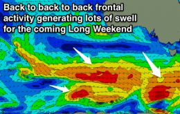
Strong SW groundswell tomorrow with the best conditions found east of Melbourne. Clean and easing Wednesday. Good new SW groundswell pulses from Thursday afternoon, largest Saturday with favourable winds.