Mainly small swells from the south and northeast

Sydney, Hunter and Illawarra Surf Forecast by Ben Matson (issued Wednesday 30th November)
Sign up to Swellnet’s newsletter and receive the Sydney/Hunter/Illawarra Forecaster Notes and latest news sent directly to your inbox. Upon signup you'll also enter the draw to win a surf trip to P-Pass for you and a mate. It doesn’t get much easier so click HERE to sign up now.
Best Days: Fri: small peaky NE swell with early light winds.
Recap: Tuesday morning saw a tiny window of clean conditions across the Hunter before the southerly kicked in; otherwise most Southern NSW beaches remained blown out during the day. A mix of swells provided low quality 2-3ft sets to south facing beaches, with smaller surf at remaining beaches thanks to a minor NE windswell. Today we’ve seen much cleaner conditions under a light variable airstream, and south facing beaches have picked occasional 2ft+ sets from a new S’ly swell, originating from a cut-off low south of Tasmania on Monday. Winds have been light all day.
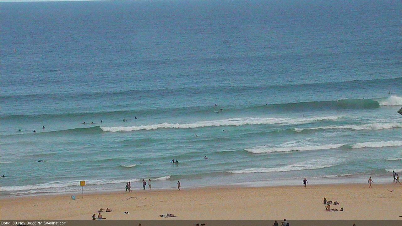
Fun waves at Bondi this afternoon
This week (Dec 1st - Dec 2nd)
Good news! The models have done a complete about-face with the progged S’ly change for tonight, that they were tipping on Monday.
A weak trough will move across the region but rather than instigating a change, it'll instead result in overnight NE winds go slack (or light and variable). A small fetch developing offshore overnight should whip up some peaky 2ft sets for NE swell magnets and there should be a comparable level of leftover (though inconsistent, and easing) south swell in the mix in the morning. The surf won't be terribly strong but if you've got a high volume board there should be a few little waves around the swell magnets.
Expect the NE breeze to pick up again in the afternoon as the trough moves offshore, which will bump up open beaches.
The restrengthening NE fetch overnight Thursday should generate a slightly bigger NE swell for Friday. It’s expected to build throughout the day and should reach 2ft to maybe 2-3ft by the afternoon across most regions (maybe a little earlier across the Sydney region).
However the swell shadow of the Hunter curve will restrict wave heights across the Newcastle and northern Central Coast. And south facing beaches elsewhere will see smaller surf size from this source.
Ordinarily local NE fetches have a reasonable potential for larger wave heights across the South Coast (owing to a longer fetch length) however in this case the head of the fetch looks like it’ll be quite far north - around Sydney’s latitude - which means surf size may not reach any appreciable size south of the South Coast. So keep your expectations in check in this neck of the dodos.
Winds look pretty good on Friday, light offshores in the morning and afternoon sea breezes with a gusty southerly change nosing into the Far South and South Coasts into the mid-late afternoon.
Also worth mentioning for Friday is a low chance for a small S/SE swell to glance the coast, originating from a broad, stationary polar low well south of New Zealand on Tuesday. This system displayed S/SW gales through the periphery of our S/SE swell window, which should send up some small inconsistent waves, somewhere in the 1-2ft range at south facing beaches. However, I am not expecting to see many waves from this system as it really wasn’t very strong and wasn’t aligned within our swell window very well.
This weekend (Dec 3rd - Dec 4th)
There's not much happening for the weekend.
Saturday will see some small trailing south swell from Friday’s late change (no major size or strength, occ 1-2ft sets at south facing beaches) plus a small secondary S’ly swell arriving late in the day, originating from W/SW winds exiting eastern Bass Strait. No major size is expected form this source either.
Winds should be light and variable with sea breezes but there’s likely to be an early lingering southerly breeze across some regions in and around the Hunter.
Similarly light winds with sea breezes are also expected on Sunday, with no new major swell sources.
However, as hinted at on Monday, we may see some very occasional sets out of the SE on Sunday, originating from a small, rare fetch well to the SE of New Zealand over the last few days.
This system looks impressive on the ASCAT returns but you have to factor in the exaggerated map projections at polar latitudes (as it almost doubles the apparent size of the fetch). And when you couple in the enormous travel distance, in reality we’re probably not looking at much more than a couple of stray 2ft sets at swell magnets.
However in the absence of any other major swell this may very well keep the exposed beaches from becoming flat, as there won’t be very much residual swell around from other sources.
Next week (Dec 5th onwards)
Still not a lot on the long term charts. We’ve still got some tropical developments to keep monitoring but they’re not showing any major signs of swell for Southern NSW.
The Southern Ocean storm track still looks zonal and the Tasman Sea looks weak and troughy, much as it did in Monday’s model runs. A strong front passing south of Tasmania around Monday should kick up a south swell for Tuesday (short range, from the front) and then Wednesday (long range, from the parent low) but at this stage it doesn’t look particularly exciting.
Let’s take a closer look on Friday, eh?