Multiple S'ly pulses, Thursday morning and Saturday looking fun

Sydney, Hunter and Illawarra Surf Forecast by Guy Dixon (issued Wednesday 30th March)
Best Days: Thursday morning and Saturday
Recap:
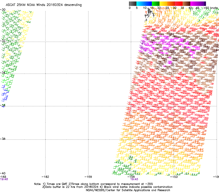 A reinforcing southerly pulse maintained options in the 3-4ft range throughout Tuesday, with fun, clean options holding throughout the day as breezes remained offshore into the afternoon. Long range energy filled in from the east late in the day, generated by a strong fetch associated with a deepening tropical low south of Tahiti (behind the swell shadow of New Zealand as discussed in detail in SE QLD notes and pictured right).
This energy is still in the water today, with inconsistent sets in the 3ft range at times, which is an over performance considering the swell the position of the source east of NZ.
This week (Thursday 31st - Friday 1st) and weekend (Saturday 2nd - Sunday 3rd):
First up, easterly energy which we have been taking advantage of today will fade from the 2-3ft range on Thursday, more so throughout Friday before a more local swell source fires up.
The offshore breezes and showers over parts of the coast yesterday and today are all as a result of a low pressure tough which has been slowly shifting offshore. A Tasman low has been developing within this trough today, with south/southwesterly breezes due to increase along it’s western flank later this evening and into Thursday morning.
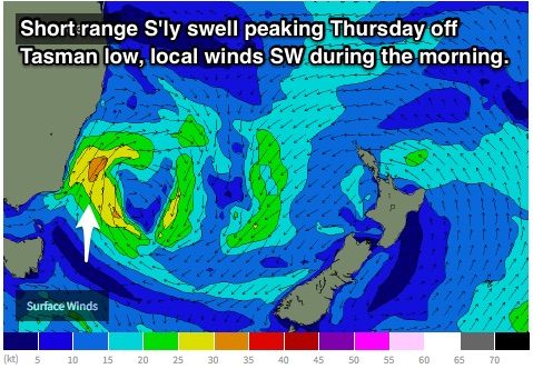 At first, this fetch looks fairly small and tight, hugging the South Coast of NSW, however as night turns to day, this fetch should have broadened, lost intensity and shifted offshore slightly.
A resultant short range southerly swell is due to build throughout Thursday, with south facing beaches building to around 3ft to occasionally 4ft by lunchtime, fading from the 3ft+ range on Friday.
West/southwesterly breezes look to dominate until late morning on Thursday, leading to clean/workable conditions, particularly across open beaches before giving way to a southeasterly airflow.
As the low moves further across the Tasman, the pressure gradient should tighten as it squeezes up against a strong ridge residing over New Zealand. A northeasterly fetch looks to increase, although the alignment of the most active part is far from ideal. The broader, weaker parts of this fetch located much further north may provide an element of inconsistent east/northeasterly swell to around 1-2ft into Saturday, although insignificant.
The forerunners of a final source of energy are due late on Friday, generated by a polar low generated southwest of WA, however more of the size is due into Saturday morning. Due to the particularly long range nature, sets will be very inconsistent, however south facing beaches should be providing sets in the 2-3ft range, fading slowly throughout the day.
Friday is looking at a light west/northwesterly breeze early, slowly swinging northerly and eventually northeasterly causing the surf to deteriorate.
A brisk change is then due to move up the coast on Saturday evening, whipping up a low quality short range windswell to around 3-4ft across the exposed south facing beaches, peaking Sunday morning, easing rapidly thereafter.
Preceding this however, northerly breezes look to persist throughout Friday night into Saturday morning, which could lead to residual scarring for Saturday’s early session. Westerly breezes look to develop as the morning wears on, sustaining throughout the day, cleaning things up for the afternoon session before the change moves through.
A second pulse of long period southerly groundswell is on the cards for Sunday, generated by an intensification within a very broad and strong frontal progression which is spanning a good portion of the Southern Ocean.
The alignment is not what we look for, but considering the active sea-state and strength of the fetch, south facing beaches may be in for another pulse to around 2-3ft. Unfortunately, options are likely to be limited to protected southern corners away from a gusty southerly breeze which will also limit swell size. As the day wears on, breezes look to ease, but tend more southeasterly.
Next week (Monday 4th onward):
The aforementioned southerly pulses will fade throughout Monday from the 2ft range.
Frontal progressions look frequent throughout the early stages of next week, although not particularly strong or well aligned. As a result, we should see the surf ebb and pulse occasionally, but not falling much lower than around 2ft.
Comments
Kick in S'ly swell, drop in period. Shorter range energy filling in off Tasman low to the south.
I'm filling in for Guy today, and am running a little late - should be online around 5:45pm. Sorry for the delay.