Distant E'ly swell bearing down on SE Qld

South-east Queensland and Northern NSW Surf Forecast by Ben Matson (issued Wednesday 5th July)
Best Days: Thurs/Fri/Sat: very inconsistent long period E'ly swell peaking around Friday, biggest on the Sunshine Coast, but also fun across the Gold/Tweed coasts and probably down to about Coffs. Expect very long breaks between sets.
Recap: Monday’s SE swell provided occasional 3ft+ sets across Northern NSW and 2ft+ sets across SE Qld northern beaches on Tuesday morning, but has otherwise faded into obscurity.
Today we’ve seen tiny surf just about everywhere. A faint signal of long period energy showed up through the afternoon, however this was a distant southerly swell generated in the Southern Ocean.
You can verify this via the Crowdy Head buoy, which picked up 16 seconds around 4am, levelling out to 14.9 seconds around 8am; Coffs Harbour then missed the leading edge (probably too faint) but saw 14.9 seconds around 10am. The swell direction was pegged as SE which is in reality a refracted long period regional S’ly groundswell in the near-shore zone. The Sydney buoy picked up a similar trace as per Crowdy Head, but some six hours earlier - leading edge of 16 seconds around 10pm last night - but conversely, the Byron buoy has barely detected anything.
As for our impending long range E’ly swell - it is yet to show on the buoys and I haven’t seen any noticeable activity on our surfcam network either.
This week (July 6 - 7)
So, it’s really just a case of watch and see what happens with this east swell.
We’ve got no more data from the South Pacific low to verify, and with no wave buoys east of the mainland (one just south of Norfolk would be very handy), all we can do is wait for the buoys to pick up the leading edge. This will probably occur overnight or early Thursday morning.
It’s interesting as to how “useful” various tools are for monitoring real-time surf conditions. I find that across the East Coast, the surfcams are great - especially our elevated cameras that show a wide spatial coverage of long sandy point breaks - because swells arriving at this coast are usually short to medium range, and relatively consistent. So you don’t have to spend as much time watching a surfcam to gauge the size of the sets.
This is quite different to the southern states, where long period groundswells are very inconsistent and it’d be quite possible to watch the cams for five or ten minutes, and completely miss a set wave (on that note, our internal data shows that the average time viewing a surfcam is a fraction of this anyway).
Buoy data on the East Coast can be tricky too, due to the (often) high level of windswell contamination, and uncertainty as to the true swell direction. As an example, last week’s S’ly and S/SE groundswells were recorded as being E/SE across the Gold Coast, which is a true reflection of the inshore conditions but not the regional direction (which impacts how much size we see across protected locations).
But in the southern states, there’s very little change in swell direction from swell event to swell event; it all generally happens between about 15-20 degrees either flank of the south-west heading.
So in the southern states, the buoys are a more useful tool as they chew up less monitoring time. On the East Coast, the surfcams tend to be more useful to gauge surf conditions.
But for this upcoming east swell, the surfcams may not be as useful as usual due to the very inconsistent nature of this swell. If you’re watching a surfcam for a couple of minutes, it’d be easy to land between sets - so you’re going to have to come back several times to accurately gauge just how big it is. As such, I’ll be keeping a firm eye on the buoy data.
And just to reaffirm the expected trend - a slow step ladder increase is modelled from Thursday morning onwards, reaching a peak throughout Friday. We should see size increase from a very inconsistent 2ft to 2-3ft+ during this time frame; this is most likely between about Coffs Harbour and the Gold Coast.
South of Coffs, surf size will likely be smaller (indeed, there’s certainly no guarantee of size anywhere, due to the shadowing effects of New Zealand), however the Sunshine Coast - being the northern most stretch of reliable, exposed coastline - is certainly a chance to see bigger sets that could very well reach an inconsistent 3-4ft+ some time on Friday.
Conditions should be clean all round with mainly light offshore winds, tending variable at times.
Lastly, in Monday’s notes I mentioned a small flukey south swell for Friday (across Northern NSW) but the models have downgraded the size and strength is the responsible fetch, exiting eastern Bass Strait tonight. Occasional 2ft+ sets should fill into exposed south facing beaches during Friday (not until the afternoon across the Far North) but it won’t provide much size elsewhere.
I’ll update things in the comments section below as and when new data becomes available.
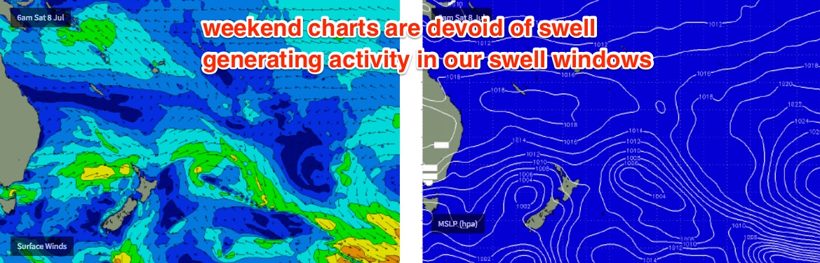
This weekend (July 8 - 9)
Make the most of Saturday morning as the swell will trend down from thereafter.
Whatever size we see on Friday afternoon will probably lose 20% overnight into Saturday morning and then by Sunday it’ll be a shell of its former self. I’m reluctant to committ to figures until I see just how big this event ends up being, but for now let’s go with a Saturday morning peak of 2-3ft+ Sunny Coast, 2ft+ Gold/Tweed/Ballina/Yamba coasts, and 1-2ft from Coffs south. Again, expect very long breaks between sets.
By Sunday there won’t be much swell at all. However conditions will be clean all weekend with offshore winds.
Next week (July 10th onwards)
A small front pushing east of Tasmania on Sunday may kick up a minor south swell for Monday afternoon or Tuesday (across Northern NSW) but it doesn’t look very interesting right now.
A broader, stronger frontal progression trailing behind looks a little more promising for a bigger mid-late week south swell, but ultimately the models are maintaining a strong zonal pattern which simply isn’t enough to kick up any major size for the East Coast. So, most of next week is looking tiny at this stage too. More on this in Friday’s notes.
Comments
That's a very small step ladder going from 2ft to 2-3ft+ over a 24-36hr period.
Yeah in hindsight "stepladder" wasn't the right word, but at the time I couldn't think of any other adjective to describe what I saw as a series of incrementally larger pulses of swell.
Leading edge came in at 15 seconds overnight but it looks faint on the buoys. Will be interesting to see what this translates to in the surf department.
Small and extremely inconsistent but distinct sets showing at D'Bah. Gonna have to be very patient though.
Easily 2ft, if not slightly bigger at D'Bah now.
Swell's hit 2ft, skis have arrived
Small lines across the Coffs coast too.
Any idea why Sunny Coast seems to be lagging behind more southerly locations Ben, given we should be seeing the most of this easterly swell?
No idea. Can only speculate that the bathymetry is steering the swell away from here, but it's unusual to affect such a broad stretch of coast.
1 ft SC at the mo bouy picking up something tho
Byron buoy has been 15 sec since 1am, but recently jumped to almost 18 sec.
That's the "stepladder" theory I was mentioning (in contrast to a solitary swell event where the highest periods are recorded first, and ease from thereafter) - though it doesn't really suit when we're talking about 2-3ft swells.
Interestingly, swell direction is E/NE which may account for the current lack of size on the SC - perhaps this swell was aimed further south? Doesn't make sense though being sourced such a long distance away.. after travelling thousands of kilometers it should have spread out in a more uniform manner.
Anyway, it's still early days so let's see how things go later this afternoon and through tomorrow.
Swell is always slow to make its way here to the sunny coast in my experience living here. Tomorrow is the best chance for a wave as in these notes.
Surfing Qld rather optimistic in today's press release (re: Occy's Grom Comp):
"The off the wall sand bank at Duranbah Beach turned on for the sixth and final day of competition... A picture perfect sunny Queensland day saw walling a-frames in the 3-4ft (1.5-2m) range".
Actually turns out they weren't far off! Wouldn't call it 4ft but looks around 3ft off the peak to me.
Sitting here @ Agnes Water waiting for this easterly swell event to show! It was virtually flat t'day whereas earlier in the week was @ least 2ft! Maybe tomorrow Ben???
I already told yas it wasn't gonna do much!
Swell was slowly inching up this arv, actually pretty fun on a good bank. As you mentioned tho Ben, really inconsistent, but with very few out it didn't matter too much.
Those lines on the north coast look like south swell rather than the other side of NZ east swell
Couple 3-4footers here on the first of the incoming tide push.
I'm certain now that what I saw rockfishing yesterday afternoon were long period forerunners from a deep Pacific source fetch.
"Here" being where?
north coast NSW south of the Cape
A few random slammers hey freeride76?
was in for the last two hours before dark around the 2ft mark very straight tho
Surf has just gotten quite loud on the sc and we're not that close to the beach . Havnt checked the bouys to see if any increases
This could be related: https://www.swellnet.com/news/swellnet-analysis/2015/11/12/why-surf-loud...
Did think of that article when writing that comment . But surely the higher swell period would be to blame. Haven't heard it all week.
Swell's here and what's that? Oh good a stiff Northerly to completely ruin it. See you ALL you know where, blerg.
Straight banks and northerlies...
Thank you sc...
Up on the SC myself this morning, was actually clean at the beachie I checked (wind was NW) but banks were in short supply and the tide was too full. Such a shame as the lines were really nice and long, looked to be in the 3ft+ range at times. Didn't bother though may do another look around this arvo.
welcome thermalben,
hope you enjoy your visit and the weather fines up for you tomorrow !
was picture perfect at start of the week, "bluebird" days to steal a phrase.
Nice long lines at Currumbin.
Hopefully that wind will stay NW offshore, few SC beachies will get fun on lower tide
Firing here this morning on the outgoing tide...sick bank to myself for about an hour before the masses slowly took over. Was consistent for about half hour periods then would get real slow for about 15 min intervals. Quality swell with some punch still after the long travel distance...my mates in NZ talked it up as some of the best waves they can remember over there.