Troughy forecast with improving beachy options on the weekend
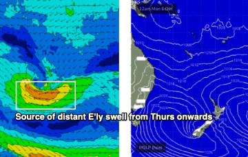
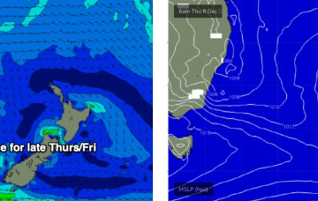
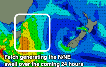
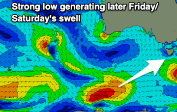
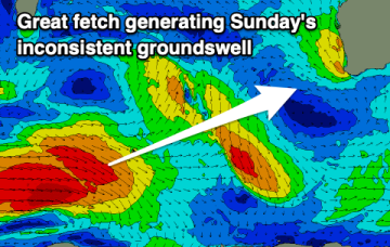
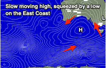
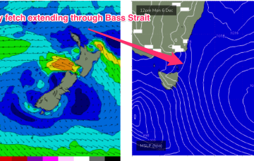
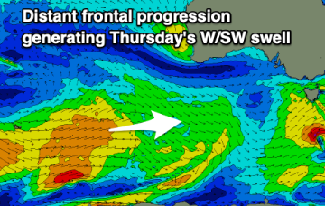
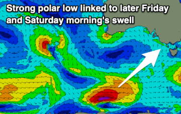
A poor end to the week and a couple of new swells, improving slowly on the weekend as the size eases.
Looks like a weekend of fresh southerly winds, and a summery mix of S/SE and E’ly swells.
A stalled trough off the coast is expected to muscle up through Thursday (see below), strengthening E/SE winds into the Far South Coast, before a Tasman Low forms along the trough line overnight Thursday, and drives southerly gales across all Southern NSW coast regions into Friday morning.
A strengthening fetch of north-east winds are producing a building north-east swell which looks best tomorrow as winds swing offshore and it eases.
A bit of swell to work with this week but persistent onshore winds will create average conditions.
How weather and gusty offshore winds with some fun new swell over the coming days.
Onshore winds and a poor mix of swells for the South Coast, tiny to flat on the Mid. The weekend should see a slow improvement in conditions.
The coming period isn't to flash at all so try and get a wave in on the exposed beaches today.
High pressure drifts towards New Zealand early next week with a strengthening N’ly flow through the East Tas swell window.
There's a strong swell on the build but conditions are bumpy and will remain so through it's peak. Cleaner smaller waves are due through the period.