Southerly winds look to be entrenched for a while to come

South Australian Surf Forecast by Craig Brokensha (issued Monday November 20th)
Best Days: South Coast Saturday morning
Features of the Forecast (tl;dr)
- Easing S/SW swell tomorrow, with a reinforcing pulse for Wed, and then again Fri
- Moderate sized S/SE windswell builing tomorrow, holding through Friday, fading Saturday
- Fresh and gusty S/SE winds tomorrow, strengthening into the PM
- Strong S/SE-SE winds Wed
- Fresh SE tending strong winds Thu
- Possible early variable winds Fri, strengthening from the S/SE-SE mid AM
- Small Sat with NW tending S'ly winds
- Moderate sized S/SW groundswell for Sun with strong S/SE winds
Recap
The South Coast offered fun waves Saturday morning with a peaky 2-3ft of easing swell with morning E/NE winds, while yesterday our large, powerful S/SW groundswell filled in, starting from the 3-4ft range with early light winds and pulsing to an easy 6ft through the day but with deteriorating conditions thanks to freshening southerly winds. Still with the strength of the swell there were still quality options for the experienced.
The Mid Coast was flat all weekend thanks to the southerly direction of the swell.
Today the swell is on the ease but with average conditions thanks to this entrenched S/SE breeze that will now hang with us through the rest of the week.
This week and weekend (Nov 21 - 26)
The outlook for the coming week and weekend unfortunately looks generally poor thanks to stubborn high pressure setting up to the south of the country, moving off only temporarily to the east before the next high strengthens and takes its place.
This along with cold fronts skirting around the southern and south-eastern flanks of the high means we’ll see a persistent, S/SE-SE gradient across the state, weakest in the mornings and strongest into the afternoons and evenings.
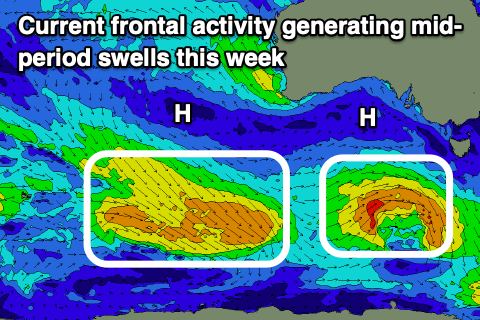
This will play out tomorrow, Wednesday and Thursday, generating moderate levels of S/SE windswell to the 3ft+ range. There’ll also be some small background levels of mid-period S/SW swell from weak but healthy frontal systems skirting the polar shelf. These only look to amount to 2-3ft, under the size of the localised S/SE windswell while the Mid Coast will remain tiny to flat.
Looking at Friday morning and there might be a temporary drop in local winds for the early but we’ll have to confirm this on Wednesday, with Saturday a better chance as a small trough forms a low west of us, directing NW winds across the South Coast. Size wise, there’ll be an easing mix of S/SE and S/SW swells to 2ft+, best on the magnets.
Unfortunately the low will be pushed east of us Saturday evening, bringing a return to strong S/SE winds, while also spoiling a moderate sized S/SW groundswell. The source of this will be a strong polar low firing up to the south-southwest of Western Australia, though with the local winds there’ll be nowhere to recommend.
Longer term there’s no let up to the southerly gradient wind, so try and make some time for other hobbies and get those dings fixed.
Comments
Blovember :(
Indeed.
The last couple of Novembers with the La Niña were actually OK but now back to the traditional Blovember as you say. Pretty relentless!
yep remember getting a few surfs in the last couple of novembers this one looks grim
Blowvember indeed! Just got blown home from Yorkes. Grim over the too.