Another pulse of E swell will bring some more fun days of waves this week.
Primary tabs
/reports/forecaster-notes/south-east-queensland-northern-new-south-wales/2021/05/10/more-e-swell
James KC
Monday, 10 May 2021

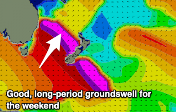
/reports/forecaster-notes/south-east-queensland-northern-new-south-wales/2021/05/07/weekend-waves
James KC
Friday, 7 May 2021
It keeps on pouring in, the E swell will provide plenty of waves with nice conditions for the early this weekend.
/reports/forecaster-notes/south-east-queensland-northern-new-south-wales/2021/05/05/extended-run
James KC
Wednesday, 5 May 2021
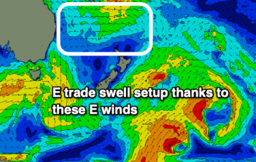
A solid E swell will continue into the weekend while a trade swell setup will keep wave heights up into next week.
/reports/forecaster-notes/south-east-queensland-northern-new-south-wales/2021/05/03/e-swell-keeps
James KC
Monday, 3 May 2021
Seemingly never ending E swell on the cards into the start of next week.
/reports/forecaster-notes/south-east-queensland-northern-new-south-wales/2021/04/30/plenty-e-swell
James KC
Friday, 30 April 2021
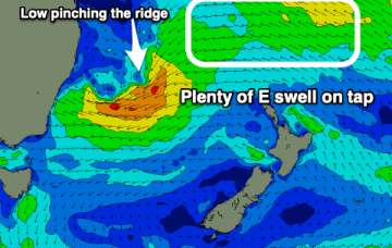
E swell filling in over the weekend and continuing into next week and beyond.
/reports/forecaster-notes/south-east-queensland-northern-new-south-wales/2021/04/28/small-waves-week
James KC
Wednesday, 28 April 2021
Waves will stay small for the end of the week but from the weekend and into next week it is looking far more intersting.
/reports/forecaster-notes/south-east-queensland-northern-new-south-wales/2021/04/26/quiet-week
James KC
Monday, 26 April 2021
Not much going on for this week but from the weekend onwards there is a good looking E swell brewing.
/reports/forecaster-notes/south-east-queensland-northern-new-south-wales/2021/04/23/s-pulses-best
James KC
Friday, 23 April 2021
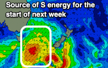
Series of S swells continue to filter in with a few days of ebbing and pulsing next week
/reports/forecaster-notes/south-east-queensland-northern-new-south-wales/2021/04/21/weekend
James KC
Wednesday, 21 April 2021
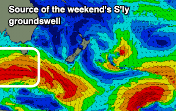
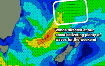
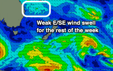
An easing swell will mean it'll be quiet for the next couple of days before a new S groundswell arrives over the weekend.
/reports/forecaster-notes/south-east-queensland-northern-new-south-wales/2021/04/19/s-swell-then
James KC
Monday, 19 April 2021
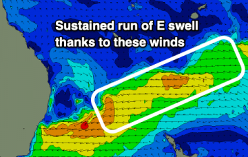
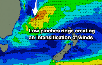
S swell will fade into the end of the week with small waves ahead of yet another S swell to fill in over the weekend.