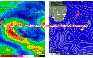
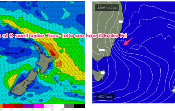
The “trough block” pattern mentioned on Wed looks to set-up as the clearing trough Mon sets up a long N-S oriented line in the Tasman to Coral Seas and focusses a long E’ly fetch through this vast area. Windspeeds are the limiting factor but we should see a steady increase in E-E/NE swell from Thurs into next weekend.
Primary tabs
/reports/forecaster-notes/sydney-hunter-illawarra/2024/07/04/se-winds-finally-easing-over-the-weekend
freeride76
Friday, 5 July 2024
/reports/forecaster-notes/sydney-hunter-illawarra/2024/07/03/winds-ease-over-the-weekend-mix-s-and-se
freeride76
Wednesday, 3 July 2024
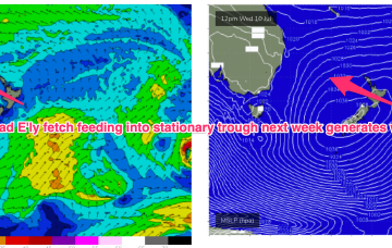
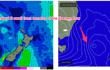
A low in the Tasman is moving north with a slingshot fetch of S-SE winds expected to rebuild wave heights from the S-SE later today and into tomorrow while a trough of low pressure in the Coral Sea is sending more E’ly angled swell into the sub-tropical Points. The combination of low and high pressure is maintain a firm ridge along the eastern seaboard with plenty of S-SE wind.
/reports/forecaster-notes/sydney-hunter-illawarra/2024/07/01/plenty-s-se-swell-week-some-workable
freeride76
Monday, 1 July 2024
Although the constant S-SE winds will be problematic there’ll be heaps of swell as low pressure remains in the Tasman, with a slingshot fetch expected as the low moves N during the week.
/reports/forecaster-notes/sydney-hunter-illawarra/2024/06/28/coupla-interesting-swells-local-winds
thermalben
Friday, 28 June 2024
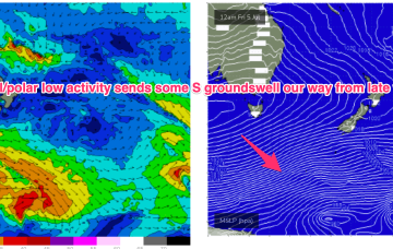
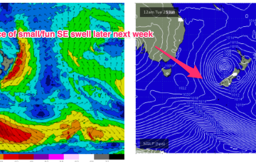
Late afternoon is on target for a sneaky long range/long period pulse of southerly groundswell, sourced from a tight but intense polar low skirting the ice shelf this weekend.
/reports/forecaster-notes/sydney-hunter-illawarra/2024/06/26/tiny-surf-and-over-the-weekend-more
freeride76
Wednesday, 26 June 2024
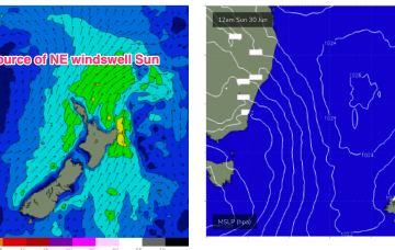
Our benign outlook runs into the weekend and right through it so there’ll be a few days better suited for rockfishing/inshore diving ahead.
/reports/forecaster-notes/sydney-hunter-illawarra/2024/06/24/not-much-all-week-probably-better
freeride76
Monday, 24 June 2024
The Tasman Sea, by contrast, is looking very mellow with a weak high pressure cell over NSW and a few decaying remnants of the long lasting Tasman Low sitting near New Zealand. Those weak pressure gradients across our main S-SE swell window will lead to a very quiet week swell wise, with mostly offshore winds.
/reports/forecaster-notes/sydney-hunter-illawarra/2024/06/21/bog-standard-windy-s-swell-ahead-run
freeride76
Friday, 21 June 2024
S’lies in the a’noon are expected to exceed 20 knots with gusts possible to 30 knots so the a’noon will be windy and mostly blown out. Short period S swell will rise as a result but keep expectations low.
/reports/forecaster-notes/sydney-hunter-illawarra/2024/06/19/slow-slow-easing-raggedy-rebuild-in-s
freeride76
Wednesday, 19 June 2024
995 hPa low still sitting in the Central Tasman, but the supporting high pressure cell has slipped in underneath the low and as a result we’re seeing a slowly diminishing fetch and easing pressure gradients both in the Tasman and along the coastal fringe.
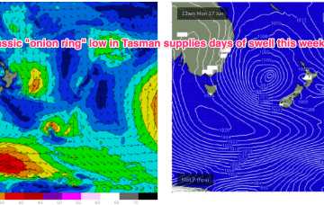
/reports/forecaster-notes/sydney-hunter-illawarra/2024/06/17/slow-moving-low-in-the-tasman-keeps-surf
freeride76
Monday, 17 June 2024
We’ve got a deep low (988 hPa) semi-stationary in the Central Tasman with strong high pressure support south-west of Tasmania and a broad coverage of strong winds to low end gales through the southern Tasman.
/reports/forecaster-notes/sydney-hunter-illawarra/2024/06/14/windy-and-sizey-the-s-weekend-some-big
freeride76
Friday, 14 June 2024
A secondary front pushing into the Tasman coalesces with a deepening low near New Zealand and the system then retrogrades back into the Tasman over an already active sea state delivering powerful S/SE swell before taking up residency in the Central Tasman for a few days next week with a slow, slow easing in big swells expected.
