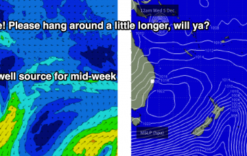
The synoptic charts are about as complex as they can get.
Primary tabs
/reports/forecaster-notes/south-east-queensland-northern-new-south-wales/2018/12/12/plenty-surf-quite
thermalben
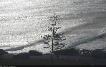
Wednesday, 12 December 2018
/reports/forecaster-notes/south-east-queensland-northern-new-south-wales/2018/12/10/extended-period
thermalben
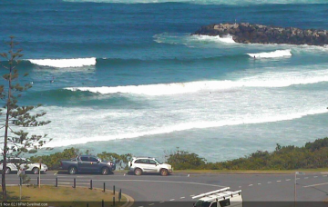
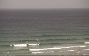
Monday, 10 December 2018
Before we get into the main synoptic even of the forecast period - a large, slow moving trough over the eastern states - it’s worth pointing out that a small low will form in the central/southern Tasman Sea on Tuesday.
/reports/forecaster-notes/south-east-queensland-northern-new-south-wales/2018/12/07/trade-swell-o
thermalben
Friday, 7 December 2018
It's looking like a points-only affair this weekend. Bring the crowd repellant! More in the Forecaster Notes.
/reports/forecaster-notes/south-east-queensland-northern-new-south-wales/2018/12/05/extended-period
thermalben
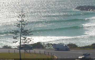
Wednesday, 5 December 2018
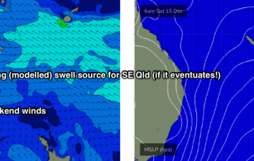
We’re looking at a blocking synoptic pattern across the Tasman region this weekend, maintaining fresh to strong trade winds that’ll keep E’ly swells at elevated heights in SE Qld both days.

/reports/forecaster-notes/south-east-queensland-northern-new-south-wales/2018/12/03/extended-period
thermalben
Monday, 3 December 2018
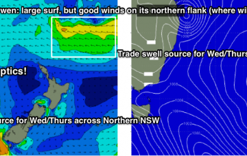
Now, these minor S’ly swells are all well and good, but how about the possible N’ly swell from TC Owen?
/reports/forecaster-notes/south-east-queensland-northern-new-south-wales/2018/11/30/fun-windows-peaky
thermalben
Friday, 30 November 2018
As was discussed in Wednesday’s notes, a developing tropical low near the Solomon Islands today is expected to drift SW towards the south-eastern tip of PNG over the weekend, and strengthen into Tropical Cyclone status. More in the Forecaster Notes.
/reports/forecaster-notes/south-east-queensland-northern-new-south-wales/2018/11/28/almost-every-kind
thermalben
Wednesday, 28 November 2018
The synoptics are pretty dynamic. We’ve got a rapidly deepening low off the Central NSW Coast that’s expected to deliver 40-50kt winds today, and in the process generate a hefty short range south swell for Northern NSW.
/reports/forecaster-notes/south-east-queensland-northern-new-south-wales/2018/11/26/plenty-great
thermalben
Monday, 26 November 2018
It will be worth scheduling in a late session at any one of the beaches, as there’ll be a peaky mix of building N’ly windswell and easing S/SE swell. More in the Forecaster Notes.
/reports/forecaster-notes/south-east-queensland-northern-new-south-wales/2018/11/23/plenty-south
thermalben
Friday, 23 November 2018
Today’s fresh offshore winds are associated with a deepening Tasman Low that’s expected to meander slowly through the western Tasman Sea for the next few days, and will deliver an extended period of short range south swell to our coast, mainly favouring Northern NSW.
/reports/forecaster-notes/south-east-queensland-northern-new-south-wales/2018/11/21/peaky-mix-swells
thermalben
Wednesday, 21 November 2018
The N’ly windswell doesn’t interest me quite as much as the incoming SE swell. More in the Forecaster Notes.