If you’ve got a south swell magnet up your sleeve you’ll do OK but its not worth getting excited about.
Primary tabs
/reports/forecaster-notes/south-east-queensland-northern-new-south-wales/2021/07/28/week-or-more
thermalben
Wednesday, 28 July 2021
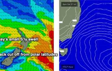
/reports/forecaster-notes/south-east-queensland-northern-new-south-wales/2021/07/26/bleak-winter
thermalben
Monday, 26 July 2021
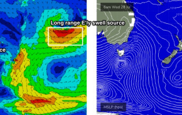
The Southern Ocean storm track remains very strong, but it’s riding quite north in latitude, across the southern states. So, there's only one swell to work around.
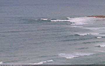
/reports/forecaster-notes/south-east-queensland-northern-new-south-wales/2021/07/23/not-great-outlook
thermalben
Friday, 23 July 2021
We’ve got a similar chance for a small flukey south swell, originated from a secondary fetch of W/SW gales exiting eastern Bass Strait on Sunday.
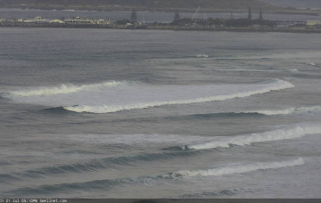
/reports/forecaster-notes/south-east-queensland-northern-new-south-wales/2021/07/21/thursday-has-few
thermalben
Wednesday, 21 July 2021
Thursday looks interesting, mainly from a weather nerd POV, not quite as much from a surfing outlook.
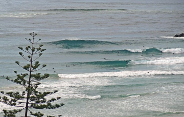
/reports/forecaster-notes/south-east-queensland-northern-new-south-wales/2021/07/19/lotta-swell
thermalben
Monday, 19 July 2021
Following the large mid-week south swell, model guidance suggests a tiny weekend with fresh offshore winds. But that may not be the case.
/reports/forecaster-notes/south-east-queensland-northern-new-south-wales/2021/07/16/flukey-swells
thermalben
Friday, 16 July 2021
With no other activity in any of our swell windows for the next 24-36 hours, I think we'll see tiny surf throughout SE Qld for the entire weekend. South of the border is a different story though.
/reports/forecaster-notes/south-east-queensland-northern-new-south-wales/2021/07/14/flukey-swell
thermalben
Wednesday, 14 July 2021
Smaller surf is expected for the next couple of days as all of our current swells ease back in size.

/reports/forecaster-notes/south-east-queensland-northern-new-south-wales/2021/07/12/period-mediocrity
thermalben
Monday, 12 July 2021
We’re on the backside of weekend’s event, but with not a great deal standing out in the forecast, you’ll be best off making the most of Tuesday’s light winds and fun surf.
/reports/forecaster-notes/south-east-queensland-northern-new-south-wales/2021/07/09/lots-windy-surf
thermalben
Friday, 9 July 2021
We’ve got a multitude of inbound energy.

/reports/forecaster-notes/south-east-queensland-northern-new-south-wales/2021/07/07/complex-combo
thermalben
Wednesday, 7 July 2021
Make the most of Thursday!