Looking Back: Winter 2021

While I've recently run a number of analysis articles: the lack of Roaring Forties, pumping surf on the East Coast, and then the southern states having their turn, this article looks at the winter season as a whole.
If we remember back to April, the Surf Coast broke its slumber after 2020 proved one of the worst winters in recent memory and continued into a poor La Niña summer. Conditions were great for a month but then things again subsided (though opening up good options on the exposed beaches), with the East Coast offering frequent good swells under favourable winds.
This trend continued into the start of winter proper, with the westerly storm track finally finding a bit of momentum through July, though not through the deep Souther Ocean. Quite the opposite, with relentless mid-latitude fronts pushing up and into Western Australia bringing relentless onshore winds and oversized stormy surf to that state, and less favourable westerly swells for Victoria.
However, on the positive side, these conditions opened up more options across the exposed beaches east of Melbourne (usually a no-go in winter) as the frontal systems were slipping south-east on approach to Victoria, clocking winds towards the north.
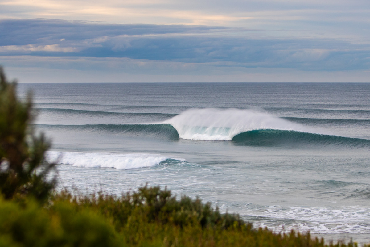
It's not all about the reefs. Photo by Steve Arklay
South Australia saw a wet, warmer-than-normal, winter owing to the frontal systems riding high, and the lack of cold polar air being advected north.
Once this pattern kicked in across the East Coast during mid-July, we saw the swell tap turned off for most locations, with small, background S'ly swell energy spreading sporadically north from fronts pushing though Bass Strait and deeper below Tasmania.
It wasn't until the end of August that we saw a more substantial and very slow moving low fire up in the Tasman Sea, bringing some larger surf to southern NSW, with a combined mix of easterly and smaller southerly swells across northern NSW and south-east Queensland.
All this can be conveyed in this Mean Sea Level Pressure anomaly chart for the three months of winter.

Mean Sea Level Pressure Anomaly for the months June, July, August (winter)
The anomaly is the difference in pressure from the climate average from 1981-2010 for the three month period and blue indicates lower than normal pressure, with yellow being higher.
What immediately stands out is the broad low pressure anomaly sitting across the southern parts of the continent and also its alignment. With it pushing so far north, we can see the influence the persistent mid-latitude storm and frontal activity had, bringing onshore winds to WA's South West, westerly winds across South Australia, and north to north-west winds across Victoria. This saw lots of westerly swell energy for South Australia and Victoria, and while the Surf Coast was mostly undersized (apart from a couple of outlying swells), it was clean and fun.
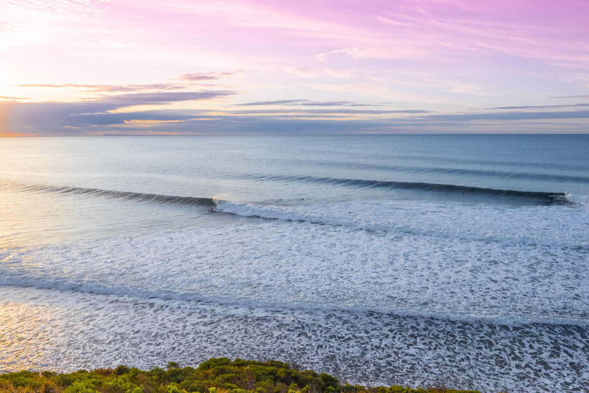
Victorian dreamscape by Romy Becker-Roache
For interest's sake, if this low pressure anomaly was shifted further south and east (and weaker), it would have indicated a more standard South Australian and Victorian winter with strong cold outbreaks and large swells from the south-west.
Looking back to the anomaly chart, what is also evident is the peanut shaped high east of New Zealand which was squeezed by tropical depressions and mid-latitude lows on its northern flank. This provided periodic pulses of fun easterly swell to the northern half of the East Coast, mainly through early July and the end of August.

East Coast magic by Craig Brokensha
The other main feature to point out is the high sitting south-east of Madagascar, across Indonesia's prime south-western swell window. What this did was limit large, long-period swells developing in that region, with Indonesia relying on a mix of mid-period and groundswell energy from the south, pushing up past the Western Australian coastline. Not a classic Indonesian season at all. However, the ridge aimed persistent south-east winds towards the Maldives, creating a constant cycle of swell for that island chain.
This final chart shows the mean (average) wind for the three month period and this reinforces the above points.
Westerly winds across the southern parts of Western Australia, tending more west-northwest across South Australian and north to north-west in Victoria. The persistent westerly winds across the Eastern Seaboard also lead to a mostly dry, clear winter with temperatures pushing well above average. The persistent south-east winds aimed towards the Maldives are also evident.

Mean (average) wind speed and direction for the months June, July, August (winter)
Comments
That's a good insight into why we had the conditions we did. Lucky for the Maldives. I heard stories of some guys surfing their resort lefts all to themselves (no more than 2 in the water) for weeks on end.
Craig > I really enjoy your big picture analysis - it's an education for me - thanks you - keep it going.
Does this current work lead you to any long- range projections for the Sept-Nov window?
Thanks, I've given a couple ago. A bit broad but you can't a slight idea on what's ahead.
This one came out perfectly to plan: https://www.swellnet.com/news/swellnet-analysis/2021/06/22/o-roaring-for...
And another: https://www.swellnet.com/news/swellnet-analysis/2021/08/24/extended-fore...
Craig > excellent, thanks for additional information.
Great stuff Craig, thanks man.
I think one thing we can take from all this is how freaking good Indonesia is for hoovering up swell no matter what's going on with the weather. Such a massive swell window. God knows when we'll be able to go back there. Probably not next year at this rate.
Yeah, more than happy with what's been served up on the Surf Coast the last couple of months. Not epic, but certainly way better than last winter. Thanks for the analysis Craig, interesting and informative as usual.
I'd give this winter an 8/10 for Victoria.
3 major swells in April was a pretty cracking start. This was followed by plenty of mid-size stuff with lots of offshores. July was bleak for the surf coast but great for the East Coast and Down South. We did three mid-winter camping trips, which are not for the faint hearted, but did result in good waves. August was OK especially with the 50 year storm swell.
Not the best winter in the memory bank, but certainly a good one. A strong Sept / October might just (as Joey Turpell would say) push it into the excellent range. Fingers crossed.