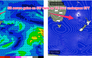
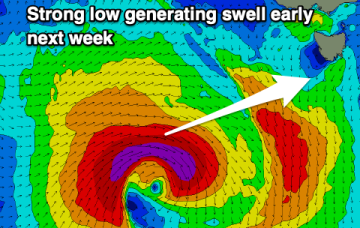
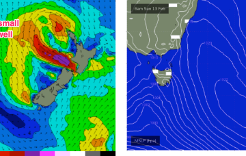
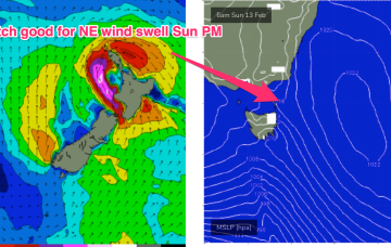
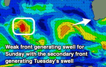
Small NE wind swell Sun PM, then not much on the radar
N’ly winds do perk up off the South Coast and into Bass Strait later Sun, which should see NE windswell lift into the 3ft range later Sun.
At 5am this morning TC Dovi was about 730 nautical miles E/NE of the Queensland border. Winds in the fetch are aimed away from the CQ coast, to targets further south, so the cyclone itself is not a swell source for the region.
Fun swells with decent winds for the coming period and plenty of windows for a surf.
The headline news is TC Dovi, which formed north-east of New Caledonia Wed a’noon and is moving SW at about 12 knots inside the Coral Sea. At 5am this morning TC Dovi was about 730 nautical miles E/NE of the Queensland border. That puts it in our swell window and although Dovi is currently Cat 3 it’s surf potential is limited by the compact fetch and expected increased speed of movement over the next 24 hrs.
Models now show the remnants of the cyclone undergoing extra-tropical transition as it slides towards New Zealand with areas of severe SE gales developing on the south-western quadrant.
The outlook is still a little mixed but the South Coast is the pick for the weekend with small Mid Coast waves next week.
The surf will improve across the beaches all weekend with a mix of fun swells. There's more swell energy on the cards from next week but winds remain an issue.
A couple of flukey westerly swells before some more significant swell energy develops for early next week.
The weekend isn’t looking great with a small mixed bag of 1-2ft surf both days, lifting a notch Sun a’noon as NE wind swell builds in under freshening N’ly winds.
We've got good pulses of swell with decent winds over the coming period and plenty of options.