Great weekend, poor most of next week

Western Australia Surf Forecast by Craig Brokensha (issued Friday 19th June)
Best Days: Saturday, Sunday
Recap
Our XXL groundswell but strong to gale-force onshore winds all filled in yesterday with a peak in size seen through the afternoon.
Today is a total different stormy with a high quickly moving in, swinging winds offshore and cleaning up a still maxing 12-15ft of swell across the South West with excellent 4-5ft waves in Mandurah, 4ft and hefty across Perth.

This week and weekend (Jun 20 – 26)
We'll see today's size drop right away through tomorrow but conditions will be good for selected breaks with a moderate to fresh E/NE breeze, shifting NE into the afternoon while easing a little. The South West should ease back from 4-6ft on the swell magnets as the swell direction clocks more SW, 2ft+ in Mandurah and 2ft on the sets across Perth, fading through the day.
Our large W/SW groundswells for Sunday and Monday are still on track and Sunday's winds are favourable, Monday through Wednesday less so.
The first pulse of long-period W/SW groundswell was generated by a great fetch of gale to severe-gale W/SW winds projected east through our swell window, south-east of Madagascar. This should build Sunday and reach 8ft to occasionally 10ft across the South West, 3ft+ in Mandurah and 2-3ft in Perth through the afternoon.
Winds look favourable for most of the day and out of the E/NE, shifting more NE through the afternoon in the South West.
The secondary pulse of reinforcing W/SW groundswell should keep the swell kicking around a similar size on Monday but winds will deteriorate. A strong N/NE breeze is due to pick up further through the day and swing more N'ly ahead of a late shift to the N/NW.
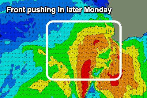 This will produce a building N'ly windswell followed by W/SW energy on Tuesday as the cold front linked to the strong winds clips the state.
Margs should come in around the 8ft+ range but with onshore W'ly winds, 3ft+ across Mandurah and 3ft in Perth. Wednesday looks to remain onshore as the swell slowly starts to ease and the outlook beyond this is a little unclear.
The models diverge on secondary mid-latitude frontal activity pushing up and into us through the middle of the week and with this we'll either see persistent onshore winds and poor conditions as the swell stays up, or cleaner easing surf into Thursday and Friday.
With the divergence you'll have to check back here Monday for a clearer idea. Have a great weekend!
Comments
Buttery, beautiful sunset waves this arvo. Love this time of year down here. Yew!
Bring back the lock down we have been invalid! Beautiful waves here too.