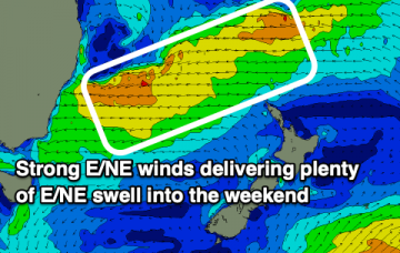
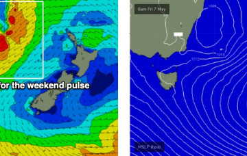
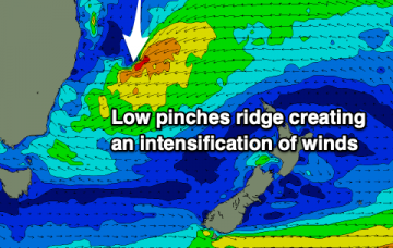
Plenty of swell on the way, with pockets of good winds
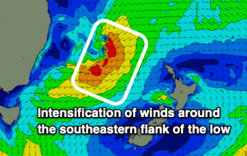
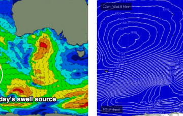
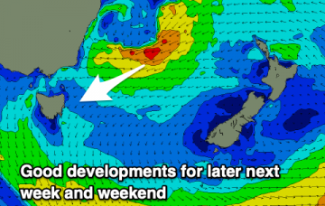
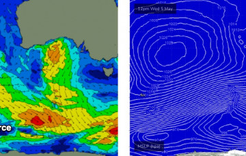
The storm track still looks really good so we’re on target for another nice round of strong autumn surf.
Larger waves will fill in tomorrow as a mid period E/NE swell forms thanks to persistent strong winds on the southeastern flank of the low.
There’s a lot to unpack this week so let’s split up the forecast into two parameters - winds, and then swell.
Thursday is where things start to get interesting.
Seemingly never ending E swell on the cards into the start of next week.
Thursday and Friday look much better, with freshening N/NE winds as a deepening low pressure trough off the NSW coast and an approaching front from the west squeezes the pressure gradient.
Plenty of action as a low creates large swell at the end of the week and into the weekend.
Early indications are for another strong long period groundswell to arrive this weekend originating from the tail end of the current storm sequence in the Southern Indian Ocean, between Madagascar and Heard Island.
Early indications are for another strong long period groundswell to arrive this weekend, originating from the tail end of the current storm sequence in the Southern Indian Ocean, between Madagascar and Heard Island.
Nothing of note for the coming period until late next week. Check the South Arm notes instead.