Solid S swell incoming, less later in the week
Monday, 17 May 2021
Solid S swell incoming, less later in the week
Monday, 17 May 2021
A S swell and decent winds will bring decent options for the next few days.
A S swell and decent winds will bring decent options for the next few days.
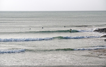
Plenty of surfing options from the reefs to the more exposed beaches for the coming period.
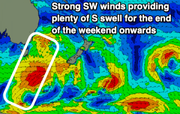
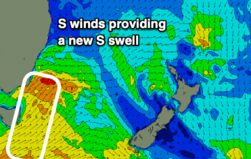
We’ve had an extended run of surf out of the north-east, however this synoptic pattern is easing back ahead of a decent round of southerly swells.
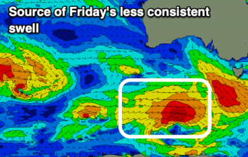
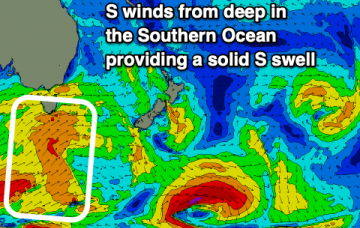
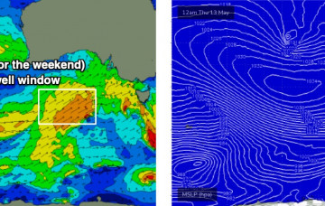
A polar low pushing along the ice shelf under South Australia on Saturday is expected to line up nicely within our S/SW swell window.
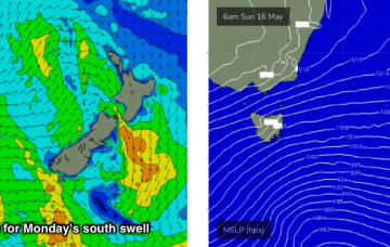
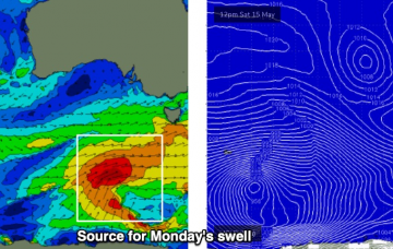
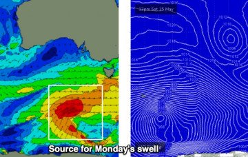
The magic run of E swell will come to an end as a series of S swells move up the coast.
The last of E swell will fade out into tomorrow (Saturday) before a series of S swells fill in.
A vigorous front will pass south of the state overnight, renewing gusty SW winds across the region - though they’ll ease steadily into the afternoon.
A vigorous front crossing the coast tonight (due into the Surf Coast between 1-3am Saturday) is unlikely to offer a brief window of early W/NW winds west of Melbourne, the timing’s simply too tight.
A high pressure system to the south of the state and a deepening trough well east of WA will maintain moderate to fresh E’ly winds across the region.
Check the forecast graph - we’ve got ten consecutive days of windy conditions coming up, initially related to an amplifying Long Wave Trough steering a succession of vigorous cold fronts across the state.