Upgrade in large swell
Monday, 6 September 2021
Upgrade in large swell
Monday, 6 September 2021
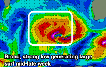
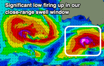
We've got an upgrade in the swell due over the coming days as a significant low fires up south-west of us.
We've got an upgrade in the swell due over the coming days as a significant low fires up south-west of us.
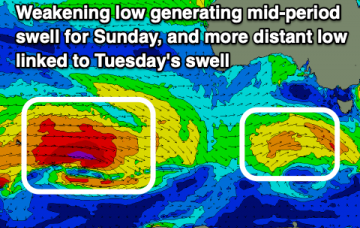
To the East a persistent, broad E’ly tradewind fetch is slowly contracting Eastwards, although windspeeds have been increased along the northern flank of a large high by an area of low pressure. This system has already produced 3 days of surf and is expected to supply a slowly diminishing signal until Thurs/Fri, from a peak today.
There'll be plenty of swell to work with this period, the hardest part will be working the winds which will spin around the whole 360° of the compass.
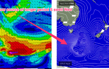
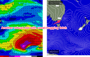
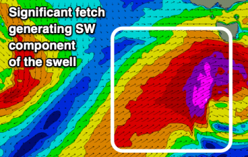
This swell will be generated by a deep low centred around 50S which is expected to track south of Tasmania, with a slight NE wobble as it transits the Tasman on Tuesday. This is a powerful storm, with storm force winds and a large area of seas in excess of 30ft, and as a result swell periods will be in excess of 15s which will produce some real bathymetric focussing effects on deepwater reefs through Wed PM as swell trains get tripped up.
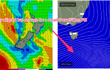
Winds from the northern quadrant with lots of swell for the South Coast, deteriorating on the weekend.
Some chunky groundswells and with favourable winds this week for the experienced.
Models have rejigged the frontal progression into the Lower Tasman next week with a less favourably aligned storm track for NETas.
An incredibly strong high pressure cell (1043 hPa) near New Zealand is driving an impressive tradewind fetch through the North Island/South Pacific corridor , as well as local onshore winds through the Coral and Northern Tasman sea.
Lots of swell on the way this period with generally favourable and workable winds.
By Mon morning the Tasman sea will be inflamed with severe gale to potentially storm force winds, as a robust low and reinforcing cold front push into the lower Tasman.