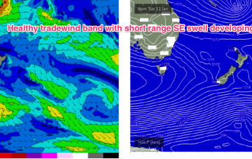
Generally poor apart from a couple of windows
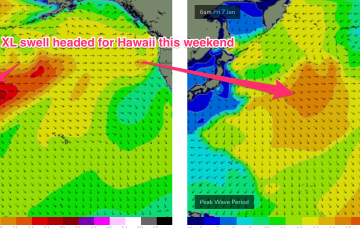
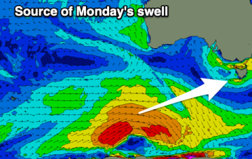
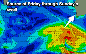
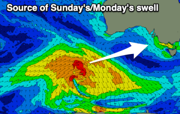
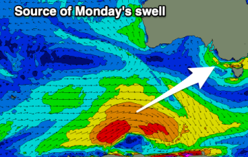
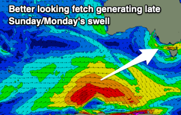
There's some OK swell due through Sunday/Monday and we've got a better wind forecast on the cards before things deteriorate into next week.
A monster storm consisting of twin lows pushing off Japan and the Kuril Islands with severe gales to storm forces winds over a huge area pushes seas in excess of 30ft to within 1000nm of Hawaii.
Winds won't play ball for the coming swells, spoiling conditions as they peak.
This fetch gets super-charged off Bass Strait and adjacent to the east coast of Tasmania by an interior trough, with E to E/NE gales expected to develop off the Gippsland coast later tomorrow (see below).
Next week looks to have better prospects although we won’t have the surf potential we saw from TC Seth.
The sub-tropical high pressure belt also extends Eastwards of New Zealand and the cradling effect of this belt along the low pressure zone is expected to create a long fetch of enhanced Tradewinds during next week.
There's no swell in sight for Perth and Mandurah and the Margaret River region is looking well below par.
A strong high is now slipping in underneath Tasmania and the combination of the decaying ex cyclone, developing high pressure ridge and an interior trough is creating a long, broad fetch E/NE winds extending from New Caledonia down into the Central Tasman Sea.
There's no quality surf due through this period with poor winds and blocking highs.
We'll see conditions improve slowly into the end of the week with a mix of sizey SE windswell and smaller, mid-period SW swell.