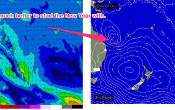
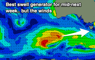
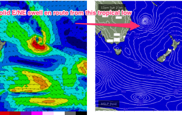
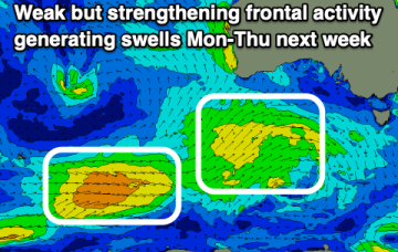
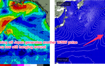
Plenty of surf next week as tropical system drifts south
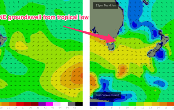
Tasmania won’t miss out with NE groundswell from the tropical system showing up Tues.
Surf prospects from this low are now confirmed as excellent with major weather models expecting the system to track parallel to the East Coast, spraying the region with swell as it does so and, possibly reforming as a significant extra-tropical storm in the lower Tasman Sea next week.
We'll see clean fun waves tomorrow morning, clean again Friday and Saturday mornings but tiny. There's a bit of swell next wind but the winds are poor.
The coming days aren't especially great with more options opening up next week.
Surf prospects from this low are now upgraded to excellent with major weather models expecting the system to track parallel to the East Coast on a Southerly path, possibly reforming as a significant extra-tropical storm in the lower Tasman Sea next week.
The outlook for the coming period isn't especially great but there are a couple of small windows worth capitalising on.
Make the most of the cleaner conditions and fun waves on the exposed beaches over the coming days before things turn to the proverbial next week.
Swell eases Wed before two more pulses of NW swell, generated by fronts pushing off the Kuril Islands, before being shunted up towards the Aleutian Islands.
Nothing special with with early light winds, cleanest and best Thursday morning.
The high pressure surge sees SE winds developing into the 20-25 knot range north of Fraser into the Capricorn channel during Wed, strengthening during the day.