Poor outlook thanks to La Niña
Monday, 10 January 2022
Poor outlook thanks to La Niña
Monday, 10 January 2022
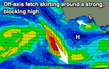
La Niña continues to bring high pressure, now swell and persistent winds from the south-eastern quadrant.
La Niña continues to bring high pressure, now swell and persistent winds from the south-eastern quadrant.
The outlook is poor for the coming fortnight so make the most of today's swell and favourable conditions.
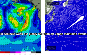
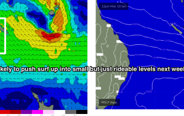
There’s not much let-up in the action next week. Storms have been spaced around 24-36hrs apart with each new fetch working on an already active sea state. This is producing overlapping swell trains, with consistent big surf expected across exposed North and West facing shores next week.
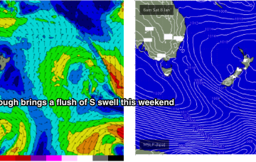
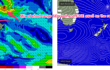
The rest of next week looks uneventful for the East Coast. A weak trough brings a slight bump in S swell Tues but its short period, weak stuff and unlikely to exceed 1-2ft.
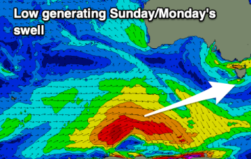
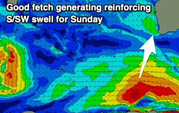
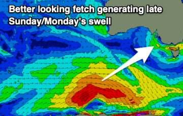
The weekend will mostly consist of windswell until Sunday afternoon, with a better swell for Monday.
This sets up a good coverage of tradewinds through the Southern and Central Coral Sea, extending out to New Caledonia, where a tropical low located between Fiji and Vanuatu is located.
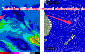
By Tues the wave climate will come more under the direct influence of the tropics, with a broad Tradewinds band being accelerated by a tropical low drifting South from area between Fiji and Vanuatu.
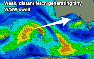
Average conditions and small swells continue with limited surfing options.
By Thurs the wave climate will come under the influence once more of the tropics, with a broad Tradewinds band being accelerated by a tropical low drifting South from area between Fiji and Vanuatu.
There are more options for a peaky wave down South over the coming period with an improvement in the local wind forecast. The swell is a bit hit and miss though.