Rare SE groundswell in the mix
Friday, 8 July 2022
Rare SE groundswell in the mix
Friday, 8 July 2022
You know things are off when we're more interested in swell arriving from the south-east.
You know things are off when we're more interested in swell arriving from the south-east.
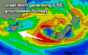
Easing S/SW swell ahead of building south-east energy but with onshore winds. Sunday will become cleaner.
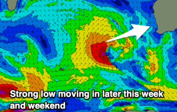
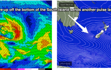
By Friday the low will have moved towards the West Coast of the South Island, where it intensifies again, generating strong surf for East Coast Tasmania.
Make the most of the current surf before things deteriorate later week and through the weekend.
A massive cloud-band is enveloping most of the Eastern Seaboard, tied to a complex low pressure system in the Tasman, and strong high pressure system with both systems slow moving. Multiple trough lines also complicate the situation, leading to uncertain movements of the main low, and development of secondary low pressure centres, of which one is forming off the Mid North Coast today (between Coffs and Port Macquarie).
A massive cloud-band enveloping most of the Eastern Seaboard, tied to a complex low pressure system in the Tasman, and strong high pressure system with both systems slow moving. Multiple trough lines also complicate the situation, leading to uncertain movements of the main low, and development of secondary low pressure centres, of which one is expected to form off the Mid North Coast today.
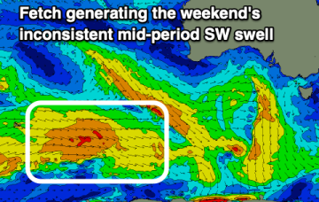
Fun today ahead of an onshore change tomorrow down South, cleaning up again on Sunday. Some better W/SW swell is due next week but with onshore winds.
There's fun waves expected across the beaches this period, in between onshore winds and localised windswell pulses.
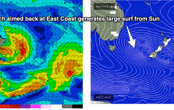
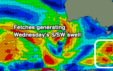
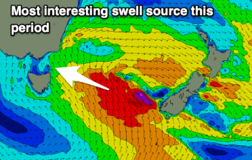
Much better quality swell arrives Sun, generated by gales near the South Island aimed back towards East Coast targets.
Clean conditions and fun swells ahead of a building S'ly swell and onshore winds Friday.