Slow ahead of a fun run of swell and clean conditions from Friday

Victorian Forecast by Craig Brokensha (issued Monday 24th August)
Best Days: Friday onwards
Recap
A good mix of swells and clean conditions on the Surf Coast Saturday morning with 3-5ft waves, poor to the east. Yesterday was a bit more unruly and not great with the swell easing back to 3-4ft. Today is smaller again and OK for the keen on the Surf Coast.
This week and weekend (Aug 25 - 30)
In the wake of the weekend’s strong frontal activity and windy swells, we’ve got a slow few days ahead before things pick up later week.
There’s no decent swells on the cards from tomorrow through Friday morning, with the size expected to drop from today and remain small and slow, though clean in protected spots. Small surf around 2ft out of the S/SW is expected on the Surf Coast tomorrow, 3ft+ to the east with a morning W/NW breeze, shifting SW around midday or so.
 Wednesday and Thursday look smaller but with offshore W/NW winds on the former and N/NW tending W/NW winds on the latter.
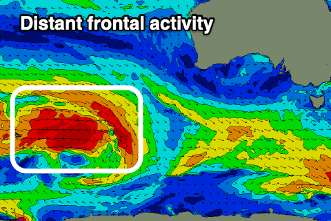
We then look west to the conveyer belt of frontal systems moving in from the southern Indian Ocean through this week, passing under the country in a weaker form before one re-strengthens south-west of us Thursday.
The current activity around the Heard Island region in our far swell window is expected to generate some inconsistent long-period W/SW groundswell for Saturday (building through the day, peaking later and likely easing Sunday). This will be very inconsistent with a peak Saturday afternoon to 3ft+ on the Surf Coast magnets, 4-5ft+ to the east.
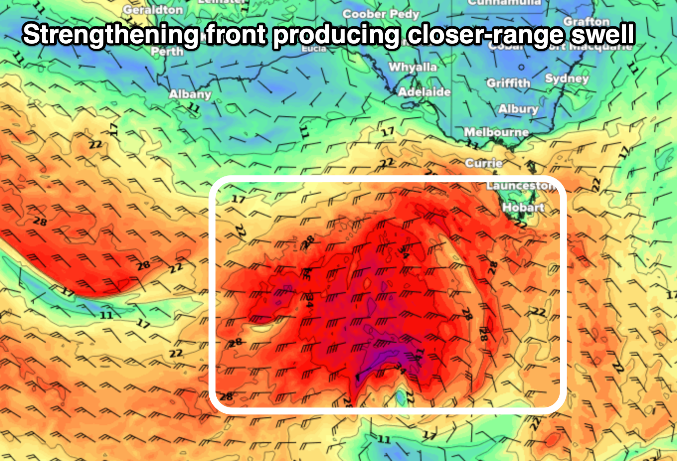 Ahead of this on Friday though, the frontal system strengthening south-west of us should produce a great fetch of gale to severe-gale W/SW winds and good kick in SW groundswell for Friday, peaking also into the afternoon. The Surf Coast should reach a good quality 4ft in the sets with 6ft+ sets on the Mornington Peninsula and a morning W/NW breeze looks to tend variable if not for weak local sea breezes. The early morning looks a bit smaller and to 2ft+ and 4ft respectively.
A slight drop is due Saturday morning, though steadying through the day with the arrival of the new W/SW groundswell. Winds on Saturday will blow out of the N’th and strengthen with an approaching front, shifting from W/NW-SW on Sunday as it passes.
We may see a small spike of reinforcing SW groundswell Sunday from an embedded low forming in the frontal progression pushing under the country, but EC doesn’t like it at this stage. Sunday’s front should bring some new mid-period swell for Monday though, with another medium sized swell on the cards mid-week.
So while the outlook isn’t anything major, there’s a fun run of waves coming for the Surf Coast from Friday.
Comments
Rumor has it - 21 on Saturday aka first day of spring. Coming out of one tunnel, stuck in another
We might actually get 10 days of waves with offshore. them miid latitude lows usually delivery when they connect together, still looking pretty small but.