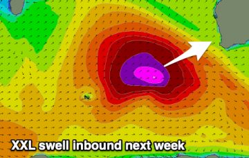
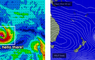
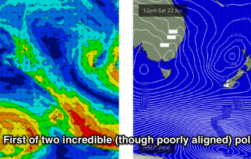
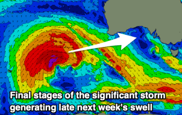
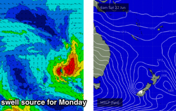
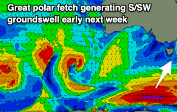
Great S/SW groundswell early next week
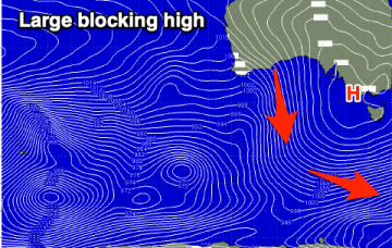
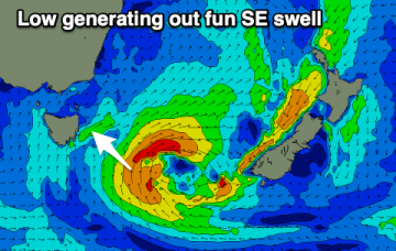
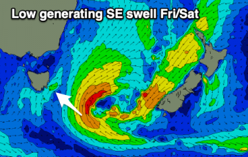
Mix of SE and SW swells on the weekend ahead of a stronger S/SW groundswell early next week with offshore winds.
Only a couple of windows of decent conditions this coming period but swell won't be an issue.
The low responsible for both yesterday’s Sly swell and the weekend’s underlying energy will meander through the southern Tasman Sea over the weekend, in a pretty decent swell generating capacity. More in the Forecaster Notes.
Looks like a windy couple of days ahead, thanks to a strong ridge of high pressure over the eastern states, maintaining a fresh southerly airstream throughout much of the NSW coast. More in the Forecaster Notes.
Workable winds and a very inconsistent swell for the weekend, slow thereafter until later next week when a large, long-period W/SW groundswell fills in.
A very inconsistent swell for the weekend and not the best winds, cleaner next week but fading. New swell late week.
So, the fetch that generated our current E/SE swell is slowly abating across the central eastern Tasman Sea. But, that’s not the only swell expected to be in the water over the coming days. More in the Forecaster Notes.
An upgrade in the surf and swell due over the coming days from a small low stalling to our south-east.
Since Monday, the models have made some major changes in the structure of the low associated with today’s southerly change. More in the Forecaster Notes.
Mix of easing W/SW swell and new SE swell over the coming days but with average winds.