Large windy swells this week
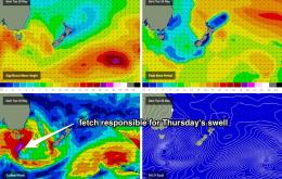
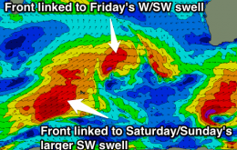
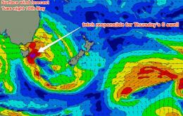
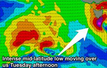
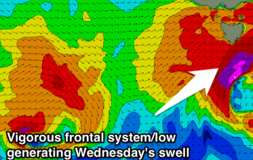
Late increase in mid-period W/SW swell tomorrow, peaking Wednesday with improving winds. Secondary pulse for Thursday with improving winds, steady into Friday.
The front crossing the coast overnight Tuesday is associated with a deep mid-latitude low tracking just south of Tasmania, and will be followed by a couple of secondary fronts, each of which will generate varying degrees of southerly swell for the latter part of the week.
Windows of cleaner conditions tomorrow and Wednesday with OK swell, onshore and becoming larger from Friday.
Easing mix of E'ly trade-swell and and NE wind swell before a S'ly pulse fills in on Wednesday.
E'ly swell should ease, before our S swell window brings the goods mid-late week.
Continuous frontal activity with tons of swell for the South Coast with favourable winds from Wednesday. Swell on the Mid but with average to poor conditions.
Stormy increase in swell tomorrow afternoon with poor winds, clean with back to back to back pulses from Wednesday, continuing most of next week.
A strong front will push through the southern Tasman Sea overnight on Wednesday, setting up a sustained south-west tending southerly fetch at gale to storm force, off the southern NSW coast.
Slowly building E/NE trade-swell over the weekend with some NE windswell also in the mid Sunday and Monday. Clean each morning and all day Monday and Tuesday.
Small SW swell for tomorrow morning, with a late new W/SW swell, peaking Sunday morning with offshores ahead of a developing SE wind.