Tricky winds with lots of varying swell pulses
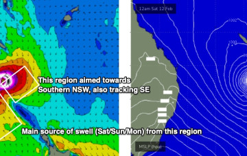
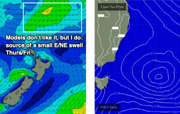
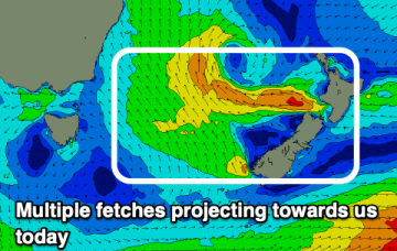
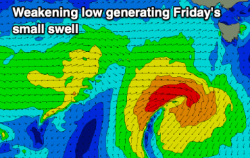
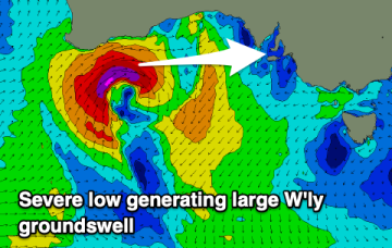
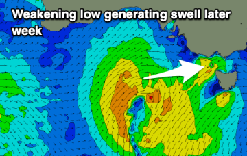
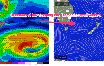
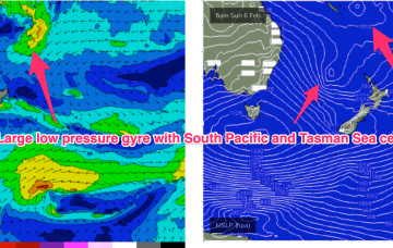
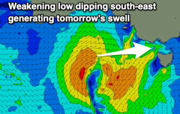
It's a tricky forecast period regarding the timing of swells and local winds but there are windows for those on the pulse.
A broad region of low pressure in the central/northeastern Tasman Sea is maintaining easterly thru’ south-easterly gales (via two seperate fetches) aimed mainly towards Southern NSW, but a healthy percentage is pushing SE energy up into Northern NSW.
The weekend’s impressive anchored ridge encompassing the Tasman and Coral Seas is now abating in strength, however we’ve still got plenty of waves on the way.
There's a good mix of easterly swells on the way for the coast, cleanest as it peaks and fun while it eases.
Nothing of note this period so maybe check the North East notes.
Small, clean waves in Perth and Mandurah tomorrow morning before the swell fades, then better later week with a new swell.
A severe low forming under the Western Australian coast will generate a large westerly swell this week.
A poor week of surf with no decent swell and onshore when it builds. Cleaner, fun waves on the beaches come the weekend.
While this swell is aimed at NSW, the fetch continues to dip south as it weakens, eventually reaching the Eastern Tas swell window later Mon.
A monster high moving through the Bight is strengthening with the pressure gradient tightened along the entire ridge line by a low pressure trough with embedded low systems in it.