Tricky weekend winds with the most size
Friday, 8 April 2022
Tricky weekend winds with the most size
Friday, 8 April 2022
Plenty of swell for the weekend but with tricky winds, best towards the north.
Plenty of swell for the weekend but with tricky winds, best towards the north.
Central QLD Forecaster Notes by Steve Shearer (issued on Fri 8th Apr)
This weekend and next week (Apr8-Apr 15)
Central QLD: Waves keep coming over the weekend and into next week
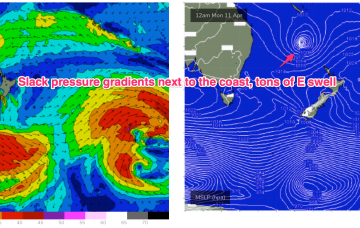
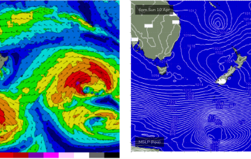
Waves have continued to pump along the Capricorn coast as TC Fili supplies plenty of swell.

Nice way to end the week
Very simple f/cast for our region this weekend so let’s not overthink it. Waves, waves and more waves on the Points with SE winds across the region.
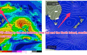
A large 1031 hPa high straddling Tasmania ( no longer a peanut high) is extending a deep E’ly flow along the f/cast region. TC Fili has weakened and is drifting southwards to the SE now of New Caledonia, anchored by a long fetch of E’ly winds from the cradling high. That equals lots of East swell through the coming days, but we’ve still got some onshore winds to slog through.
Lots of surf this period though you'll still have to work the local winds. The weekend looks best for the South Coast but smallish.
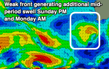
Winds will remain an issue this period but they'll abate in strength opening up more windows of surf. There's plenty of swell inbound as well.
Generally favourable winds and swells from the south-east to west.
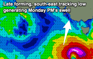
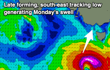
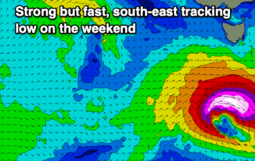
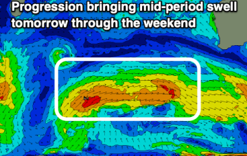
A strong low which passed through the Tasman is also sending a quantum of longer period S to S/SE swell which will see surf heights build from the S to SSE over the next 24-36 hrs.
Fun swells with Perth and Mandurah offering the most favourable winds but the South West will have moments.
TC Fili’s initial WSW to SW movement generated a NE swell that is now supplying really fun surf in the 2-3ft range to the region and this is expected to continue through tomorrow.