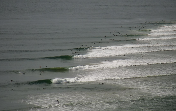
Tons of swell but onshore at times
Wednesday, 20 April 2022
Tons of swell but onshore at times
Wednesday, 20 April 2022
There's a truck full of swell inbound but winds won't be as favourable as they have been of late.
There's a truck full of swell inbound but winds won't be as favourable as they have been of late.
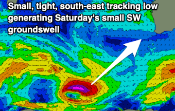
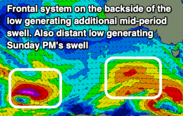
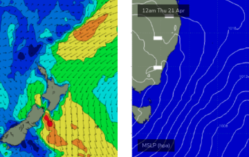
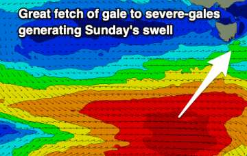
Into the weekend and there’ll continue to be plenty of strong polar frontal activity in our swell window but it’ll be mostly too zonal to generate any major size. Models now show a slightly stronger fetch with a bit more surf potential for S facing beaches on Sunday.
Just small waves over the last few days but the outlook is looking promising as a monster high starts to build a firm ridge along the CQ Coast over the next few days. This ridge is enhanced by an area of low pressure on the Cape York Peninsula.
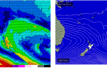
Further out in the South Pacific, well to the NE of the North Island, the remnants of the long trough line through the eastern swell window, have deepened, with a broad fetch of E/NE to E winds now activated
Further out in the South Pacific, well to the NE of the North Island, the remnants of the long trough line through the eastern swell window, have deepened, with a broad fetch of E/NE to E winds now activated.
A final reinforcing S/SW groundswell tomorrow with clean conditions, smaller and fading Friday. The weekend will be slow with one small swell, windy and onshore next week
We'll see a good mix of swells tomorrow, becoming large down South with great morning winds. Make the most of it as winds will deteriorate into Friday.
A strong mix of swells is due tomorrow but options will be severely limited. Winds will slowly ease and improve from the weekend but more so early next week with fading surf.
There's no letup in the surf outlook for our region.
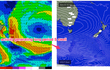
The northern Tasman trough that generated the last few days of east swell has intensified a small new fetch just off the west coast of New Zealand's North Island.