XL swell tomorrow, pumping Wednesday
Monday, 2 May 2022
XL swell tomorrow, pumping Wednesday
Monday, 2 May 2022
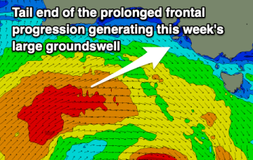
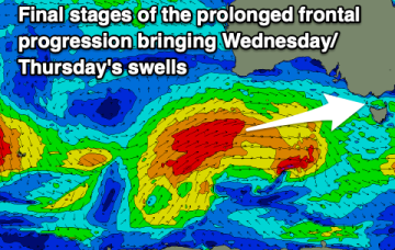
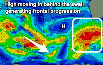
A rapid increase in XL swell tomorrow, best in protected spot when it peaks. Windy but pumping surf, easing Wednesday.
A rapid increase in XL swell tomorrow, best in protected spot when it peaks. Windy but pumping surf, easing Wednesday.
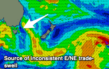
High pressure is sitting over the interior of Central NSW, leading to SE wind conditions, with a trade flow in the South Pacific supplying a steady drumbeat of fun, mid-sized E’ly swell.
High pressure is sitting over the interior of Central NSW, leading to SE wind conditions, with a trade flow in the South Pacific supplying a steady drumbeat of fun, mid-sized E’ly swell.
High pressure is sitting over the interior of Central NSW, leading to wonderful, settled conditions, with a trade flow in the South Pacific supplying a steady drumbeat of small, fun E/NE swell.
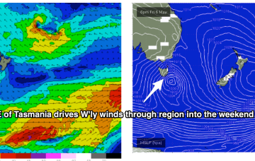
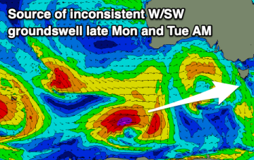
Great surf down South tomorrow ahead of a change and large swell through Wednesday/Thursday, though clean options will be hard to come by.
Lots of swell with favourable winds for more protected spots from Wednesday. Better though windy on the beaches tomorrow.
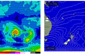
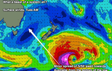
The broad trade pattern supplying the weekend’s swell source will become enhanced over the coming days as a tropical low between New Caledonia and Fiji this weekend squeezes the synoptic flow.
A quick scan of the hindcast charts shows a phenomenal polar low well SE of New Zealand, generating a Code Red swell for Tahiti - but it’s just on the periphery of our flukey SE swell window and will probably generate some small intermittent sideband energy.
There's nothing major on the cards this week with a small swells to pick at.
A slow period with tiny surf on the weekend and small, westerly swells next week.