Easing winds and abating swell
Wednesday, 3 August 2022
Easing winds and abating swell
Wednesday, 3 August 2022
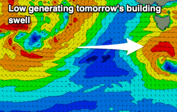
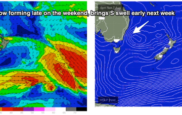
The large low pressure gyre currently impacting the state will start moving east over the coming days.
The large low pressure gyre currently impacting the state will start moving east over the coming days.
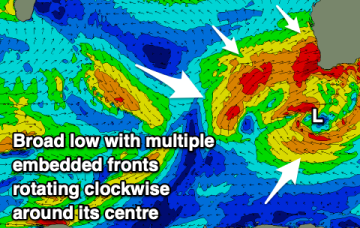
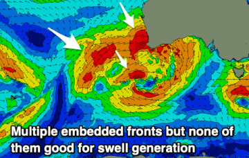
Our Tasman Sea and Coral Sea swell windows remain very subdued as we move through the week. A monster, complex low system is slowly moving south of the Bight, expected to decay as it enters the Tasman Sea over the weekend.
Lots of wind and lots of swell incoming for the Mid Coast over the coming days.
There's nothing of not expected over the coming days with the swell being to west to make an impact through Bass Strait. Next week offers a few more surfable days.
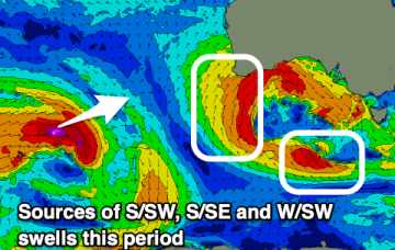
The high pressure belt is moving at a more typical northerly latitude over interior Australia and with weaker, more mobile high pressure moving over the interior and into the Tasman, we are looking at a period of N’ly biased winds with W’ly oriented fronts being quickly shunted across the Tasman.
A slow period with a small pulse of localised W/SW swell tomorrow, fading Wednesday.
XL swells and strong to gale-force onshore winds will dominate the coming days.
We’ve finally come to a low spot in the current La Niña phase we are in with energy being dialled right back this week. The high pressure belt is moving at a more typical northerly latitude over interior Australia and with weaker, more mobile high pressure moving over the interior and into the Tasman, we are looking at a period of N’ly biased winds with W’ly oriented fronts being quickly shunted across the Tasman.
Plenty of westerly swell later this week but with average winds for the Mid Coast. It'll be too west for the South Coast, but there's a fun S'ly swell due Saturday.
We’ve finally come to a low spot in the current La Niña phase we are in with energy being dialled right back this week. The high pressure belt is moving at a more typical northerly latitude over interior Australia and with weaker, more mobile high pressure moving over the interior and into the Tasman, we are looking at a period of N’ly biased winds with W’ly oriented fronts being quickly shunted across the Tasman.