Fun sized NE swell with a good wind change Friday
Wednesday, 21 September 2022

Fun sized NE swell with a good wind change Friday
Wednesday, 21 September 2022
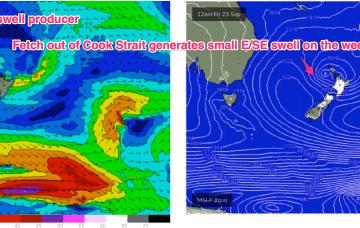
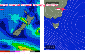
The pressure gradient is tightened as the low approaches with an increase in NE winds and swell expected through the end of the week. A small low exits the coast north of Coffs Harbour, which delays the offshore flow and maintains a N’ly wind across the region until a front brings an offshore change Fri. The return S’ly flow as another small low and front develop near Tasmania late Fri/Early Sat is expected to kick in over the weekend.