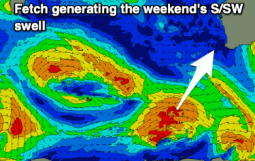
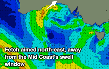
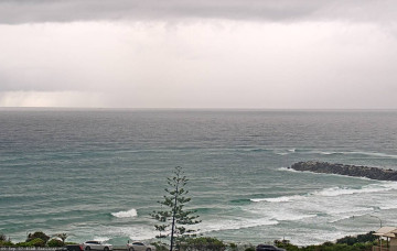
Small slow weekend, then some south swell next week
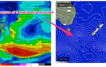
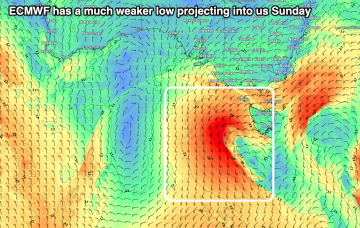
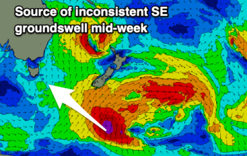
A longer period swell originating from storm force winds around the parent low is then scheduled to arrive across Northern NSW on Wednesday.
Next week looks typical of Spring with a series of strong fronts transiting through our south swell window, although at somewhat low latitudes.
Poor end to the week with building surf later in the weekend and more so next week but with poor winds.
The high will move E with a N’ly flow rapidly developing as pressure gradients get tightened by an approaching front, complex low and trough line, generating solid NE windswell.
The Tasman low is out of the swell window and a large high is now moving over Tasmania to take up position in the Tasman Sea at a southerly latitude typical of the high pressure belt under the La Niña phase of the ENSO cycle. The high will move E with a N’ly flow rapidly developing as pressure gradients get tightened by an approaching front, complex low and trough line.
A fun swell and cleaner conditions across the South West over the coming days ahead of a poor, stormy run of waves next week.
There's nothing of quality or size due over the coming days with better surf potential on the South Coast early-mid next week.
Slow though clean conditions on the exposed beaches to end off the week, poor on the weekend and early next week.
Easing S swell with cleaner conditions tomorrow. Windy for the rest of the week from the NE with a SE swell.